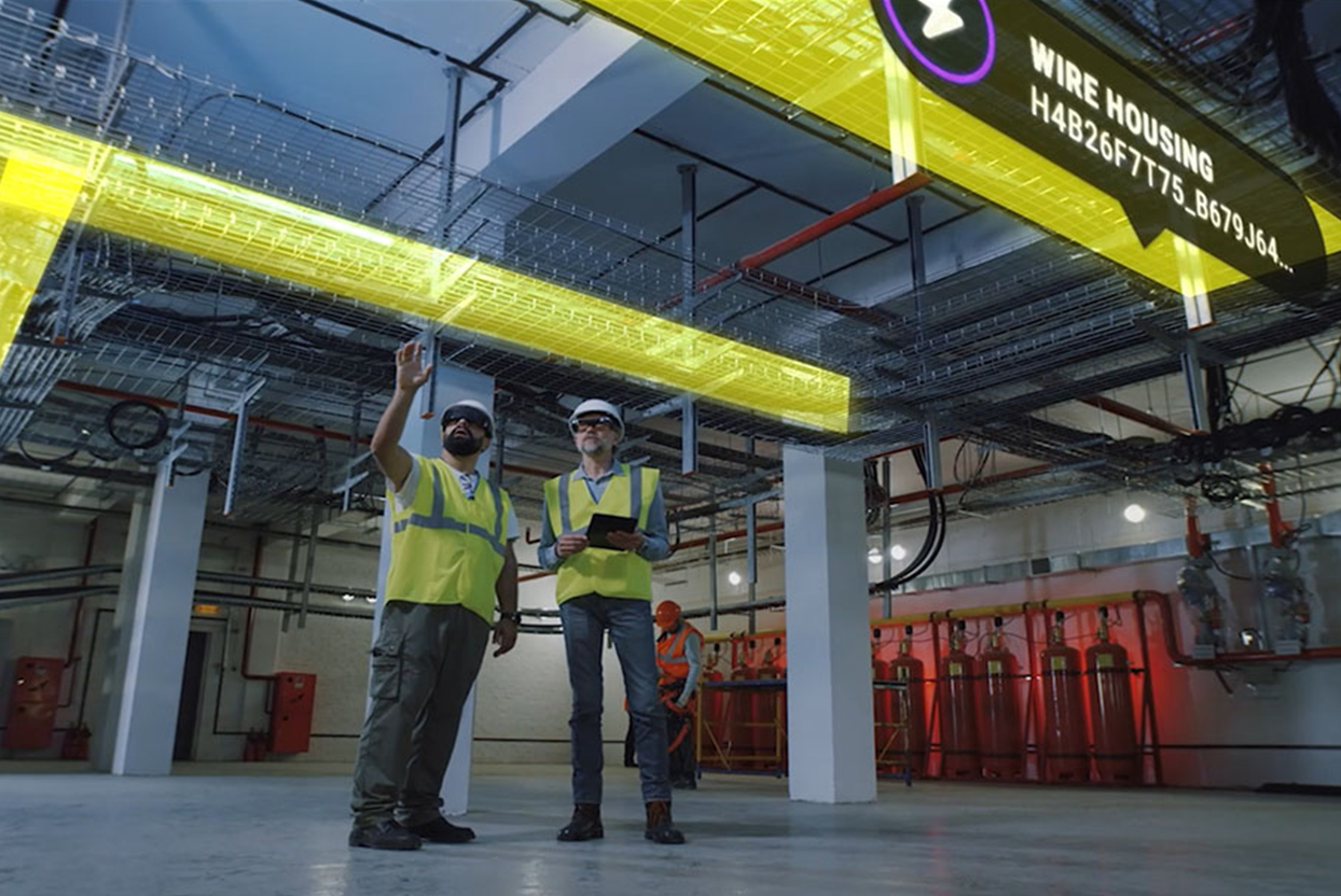
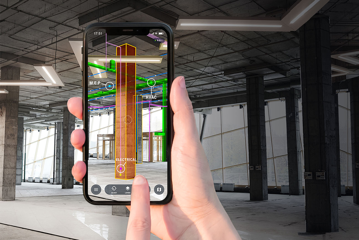
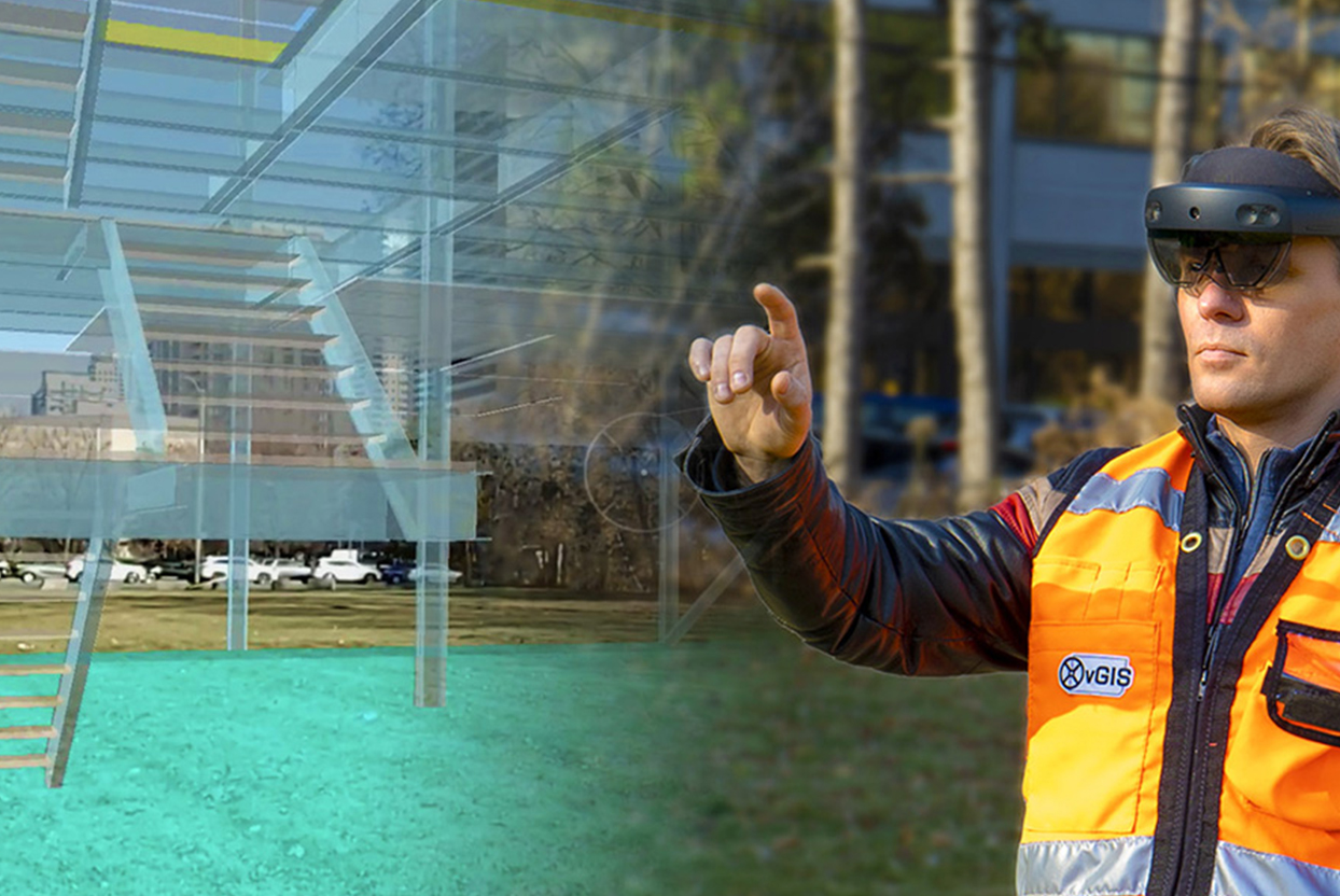
AR for Building/Vertical Construction
Construction-grade augmented reality system for building construction and indoor projects.
Construction-grade augmented reality system for building construction and indoor projects.
Displaying design drawings as 3D objects in Augmented reality and digital twin gives you:
Project efficiency with improved collaboration, simplified workflow, improved communication, and increased productivity.
Project quality with improved accuracy, issue resolution, and error reduction.
Project safety with better understanding of your surrounding and improved work safety environment.
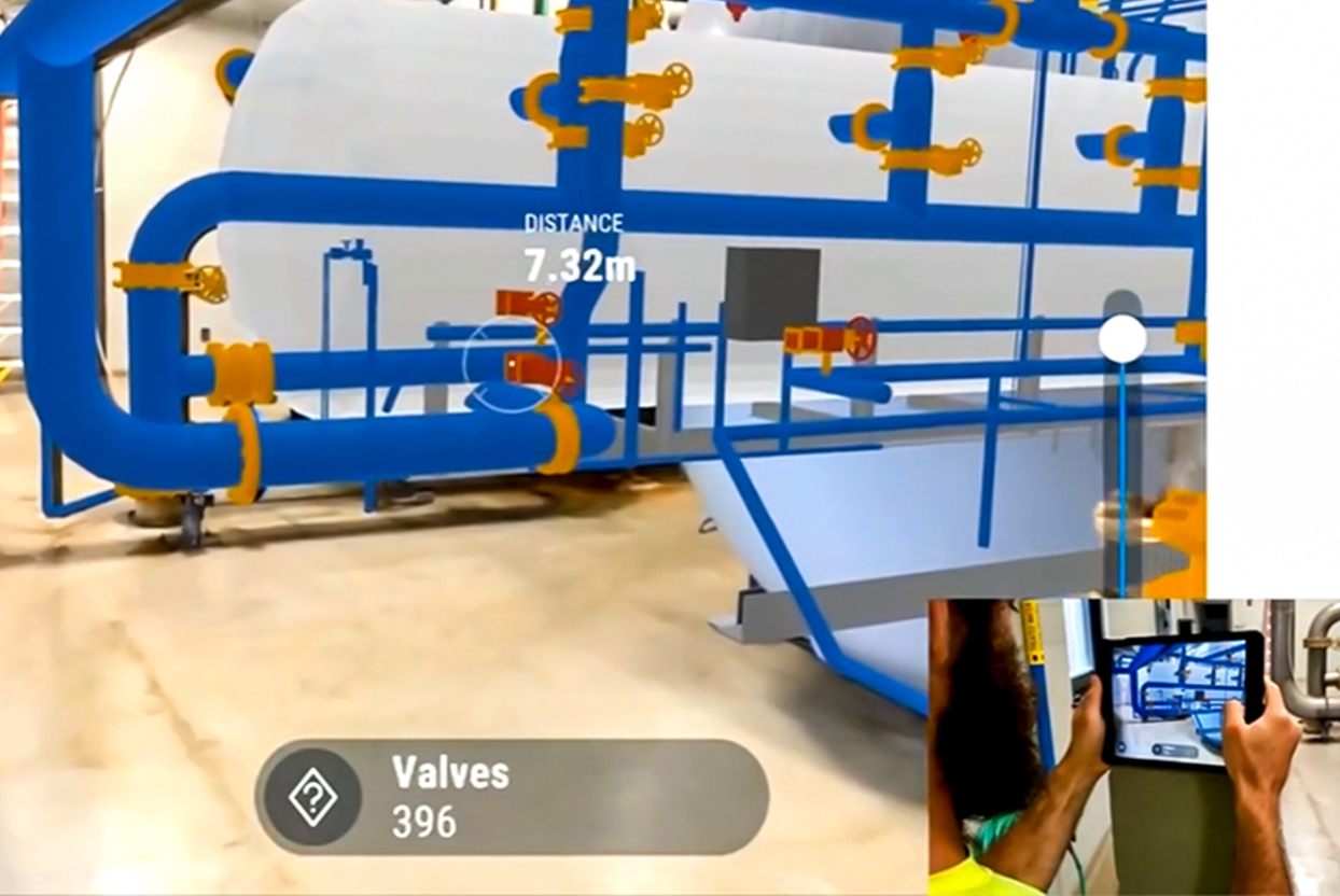
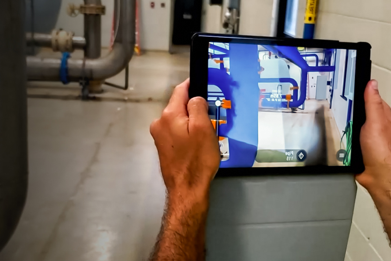
vSite is easy to use and automatically creates an accurate 3D digital twin and Augmented Reality of the worksite using design files including BIM and GIS datasets (IFC, DWG, DXF, and many others) or from Common Data Environments (CDEs) Autodesk Construction Cloud (BIM 360), Bentley iTwin, Esri ArcGIS, and many others.
Price Details 1 Price Details 1 Price Details 1 Price Details 1 Price Details 1 Price Details 1
45 USD/month (billed annually)
Bring your BIM data to your construction site. Powerful integrations with Esri ArcGIS, Bentley iTwin and other sources enable fully automated model retrieval directly from your project repositories, which eliminates the manual effort required to convert BIM and GIS data into 3D objects. Location services display information relevant to each individual user directly on-site.
Announcement from the recent release of the vGIS Indoor AR functionality. The engineering-grade augmented reality from vGIS is deployed to address multiple aspects of a typical construction project – from stakeholder engagement to QA/QC checks to project documentation with reality capture.