vSite AR: Construction-grade augmented reality
Precision AR for safer, faster, and more accurate work. Prevent strikes, capture as-builts, perform stakeouts, and more—all in one intuitive, user-friendly app.

Precision AR for safer, faster, and more accurate work. Prevent strikes, capture as-builts, perform stakeouts, and more—all in one intuitive, user-friendly app.
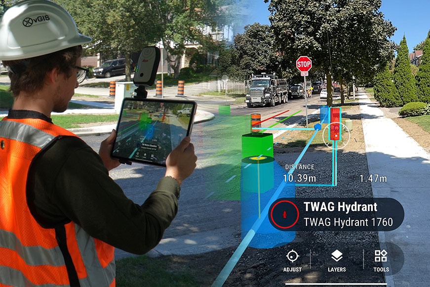
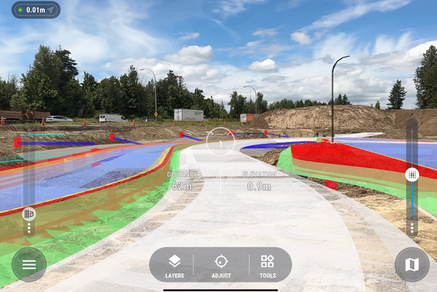
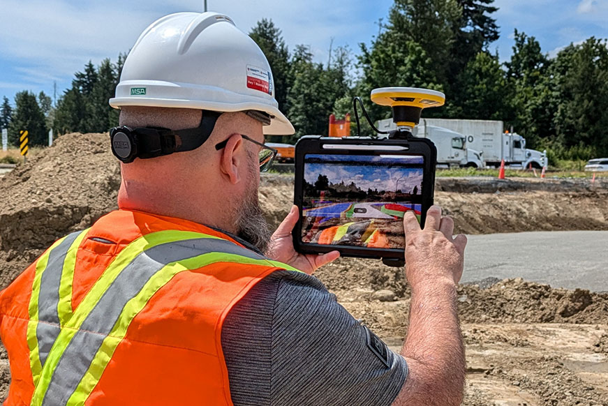
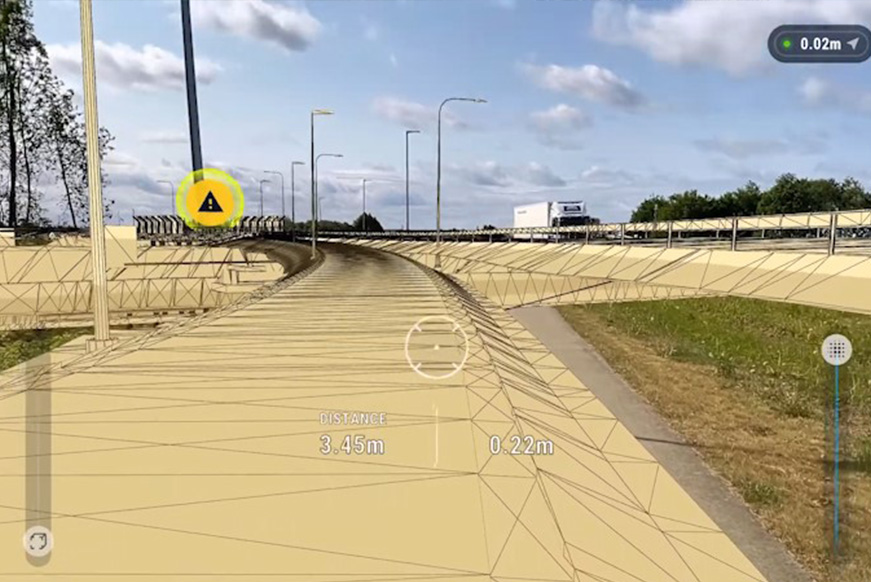
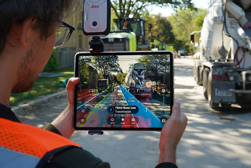
Construction-grade augmented reality with cm-level accuracy enables crews to see underground utilities, design plans, and as-built overlaid directly on site conditions, making it easy to spot discrepancies instantly.
By perfectly aligning digital and physical environments, vSite AR helps crews avoid line strikes, perform quick quality control checks, and ensure field data matches the plan before work progresses.
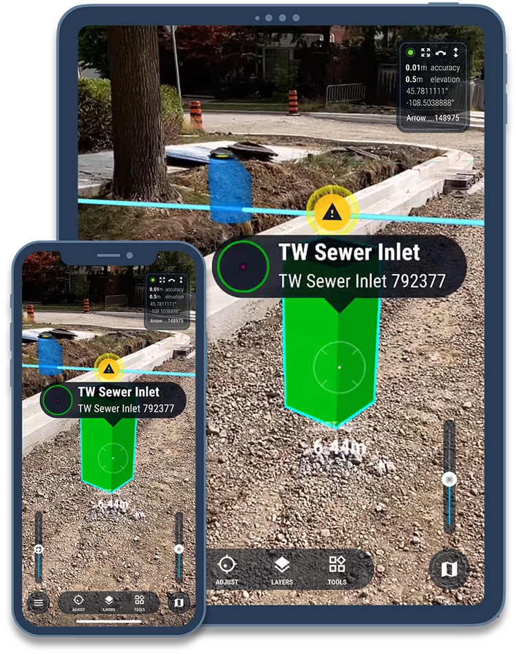
With the ability to perform stakeouts, instantly validate picked-up points, and collect as-built, vSite AR lets crews work more independently, reducing reliance on surveyors for routine checks and verifications.
| Key vGIS Features |
Prevent Utility Strikes: Visualize underground utilities in precise AR before excavation begins, helping crews avoid costly and dangerous incidents.
Bring Plans to Life: Overlay drawings, BIM models, GIS layers, and design drawings on the live jobsite for instant alignment and quality checks.
Accurate Stakeouts: Use AR overlays with cm-level positioning to guide crews in placing assets exactly where they need to go.
Spot Issues: Identify and resolve clashes between design plans and actual site conditions early, reducing rework and delays.
Create As-Built On Site: Redline changes and produce accurate as-built directly from your device, eliminating delays from surveyor scheduling. Use AR to validate as-built accuracy to eliminate errors.

reduction in utility strikes
fewer survey crew visits
Design reviews are easier when you can see a to-scale model right on site.
Together with Net4s, KLIC data and other regional-specific data for construction and utility projects can be visualized in augmented reality for real-time data review.