End-to-End Management for Utility Projects

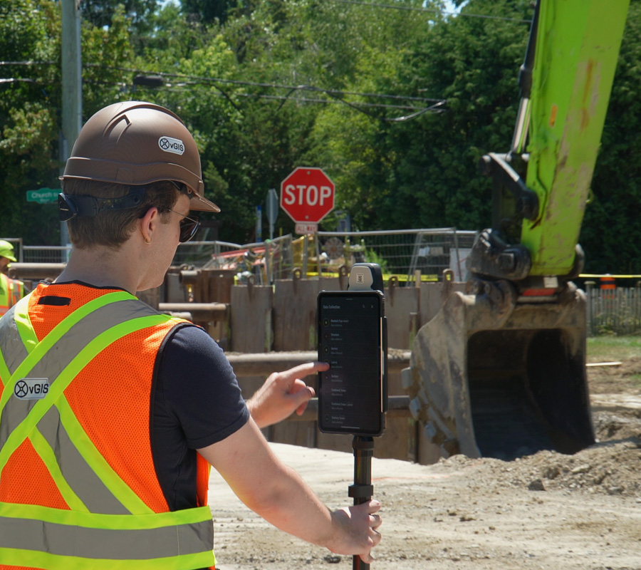
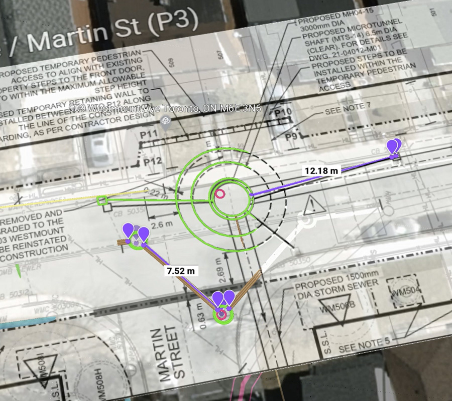
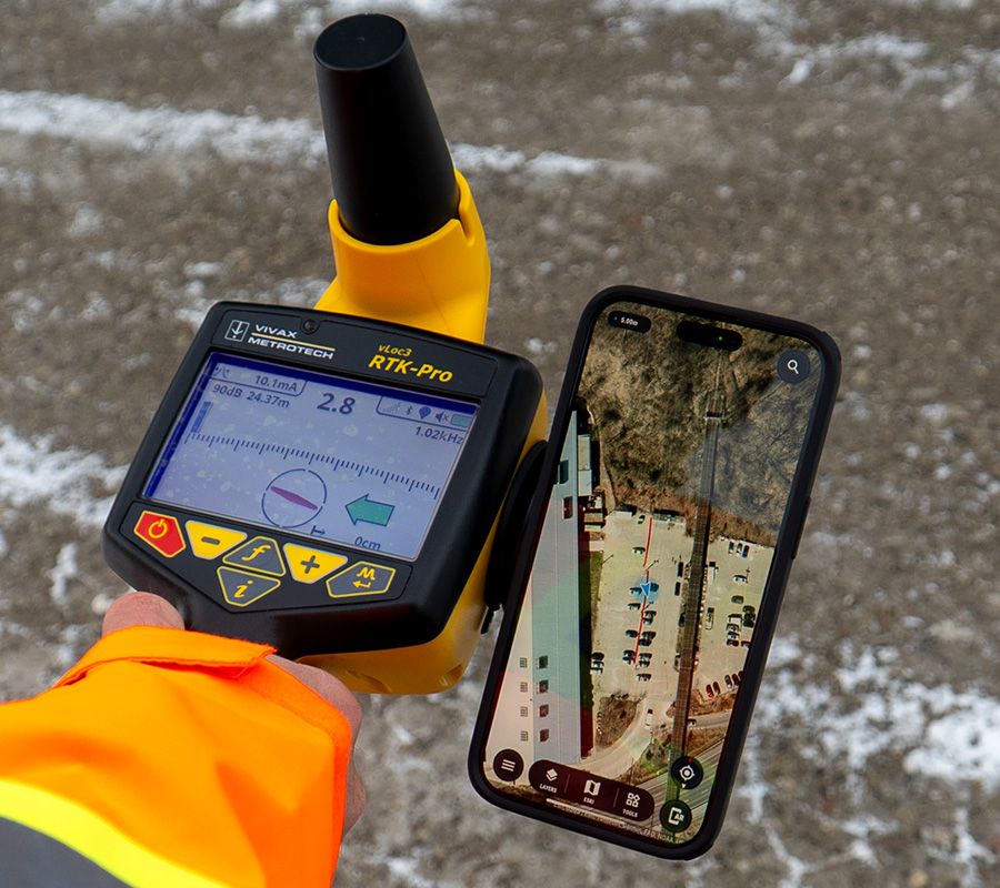
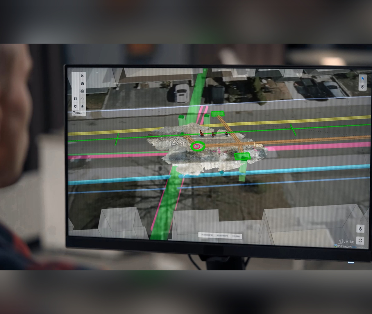
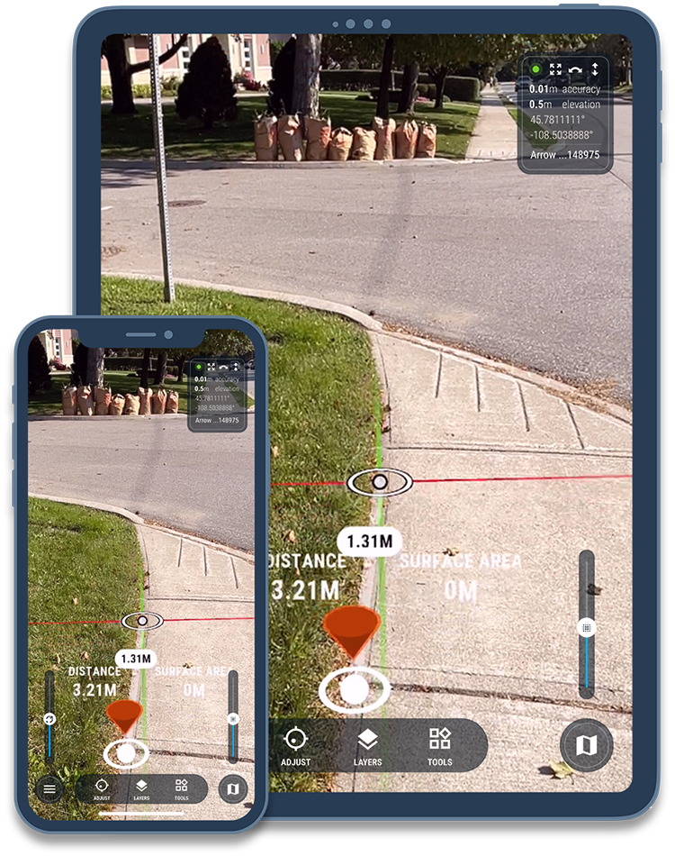
vSite offers utility owners a powerful platform to track progress, verify installed quantities, and perform inspections. All redlines, as-builts, utility maps, and GIS data are centralized into one real-time system so you always know what’s been built, where it is, and what’s still left to do.

Unified Project Visibility

From planning through handover, vSite provides a single, real-time view of everything that happens on the jobsite. All your field data and plans are synced between crew and office, so teams stay aligned.

vSite “connects your data and teams in real time,” reducing errors, rework, and delays. Utility owners gain a shared source of truth: an always-current digital twin of the project that shows exactly what assets are installed, where, and when.

Case Study Coming Soon

System Highlights

Real-Time Quantity Tracking: Log installed pipes, manholes, and conduit on-site as work happens.

Inspection & Reporting: Automated daily reports, notes, photos, and notes are tied to locations with timestamps, simplifying compliance.

Field Data Capture: Mobile redlining, GIS data collection, and 3D scanning let teams create accurate as-builts in the field.

Utility Locate Documentation: Georeferenced locate records (scans, locator output) are generated as locates occur and then stored permanently in vSite.

Digital Twin & Data Sync: A continuous, 3D jobsite model keeps field and office teams aligned with up-to-date project data.

The Benefits of Deploying vSite

  • Real-Time Project Visibility: Track construction progress, quantities installed, and field activity as it happens.
  • Streamlined Inspections: Perform and verify inspections with time-stamped cm-accurate 3D scans and photos
  • Faster Closeouts: Clear records and automated reporting speed up project handover
  • Timely As-Builts: 3D scans and redlines provide information about what's in the ground in real time
  • One Source of Truth: vSite connects all field data, drawings, and models into a live digital twin
  • Fewer Disputes: Verifiable records and automated reporting help resolve claims

Previously, it was just a point or a line on a map. Now, people can precisely visualize where the new work will take place. With vSite, we scan the site, gather accurate data, and quickly move on to the next phase.

  • Dirk Bakker, Specialist GIS & Data
  • NTP

See vSite in Action

Simplifying Underground Work with the vSite

vSite Overview

Additional Information

Features

vSite features

Learn more

Technical details

vSite technical specification

Learn more

System benefits

vSite saves you time and helps avoid costly mistakes

Learn more

We've received your request. Thank you.

We've received your request.