All-in-One Toolkit for Utility Contractors
Give your crews an intuitive tool to prevent utility strikes, capture field changes, perform stakeouts, produce accurate redlines, and track installed quantities – all through a single, easy-to-use app.

Give your crews an intuitive tool to prevent utility strikes, capture field changes, perform stakeouts, produce accurate redlines, and track installed quantities – all through a single, easy-to-use app.
vSite covers the most common project needs in one package. Instead of juggling separate tools for damage prevention, redlining, stakeouts, and reporting, contractors can rely on vSite as a single source of truth.
Built in collaboration with general contractors, utility owners, designers, and locators, vSite addresses real-world challenges to keep municipal infrastructure projects running smoothly.
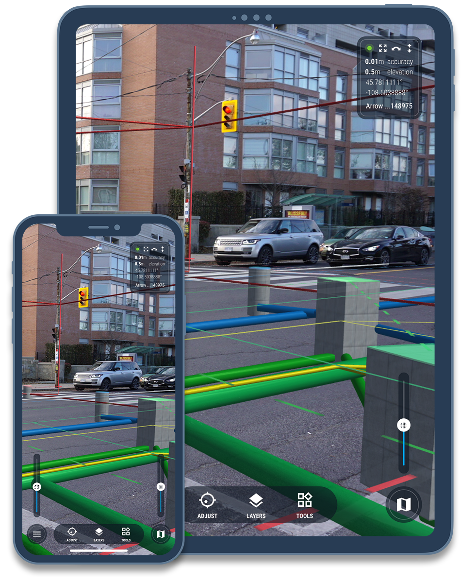
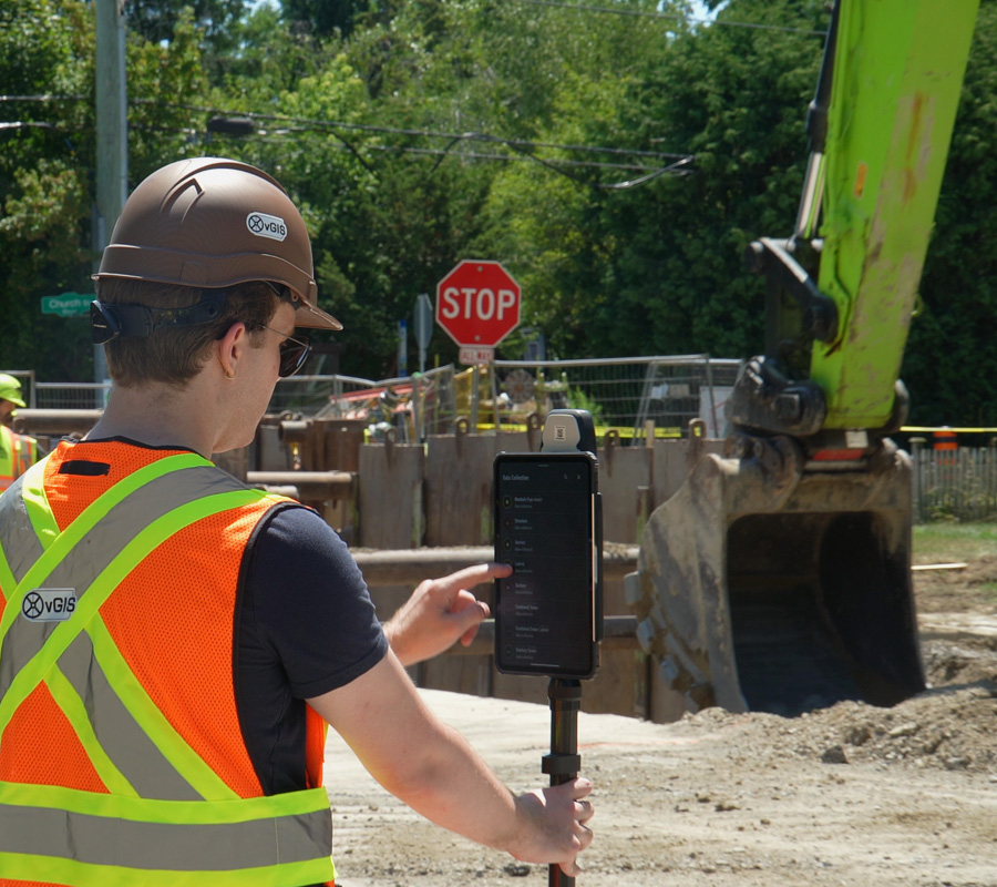
Crews can see underground utilities before digging, record exactly what’s been installed, and collect survey-grade points – all within the same platform. The result is a more efficient workflow where critical data flows seamlessly from the trench to the office in real time, eliminating tedious manual transfers and redundant paperwork.
| Industry Case Study |
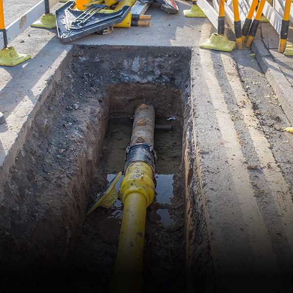
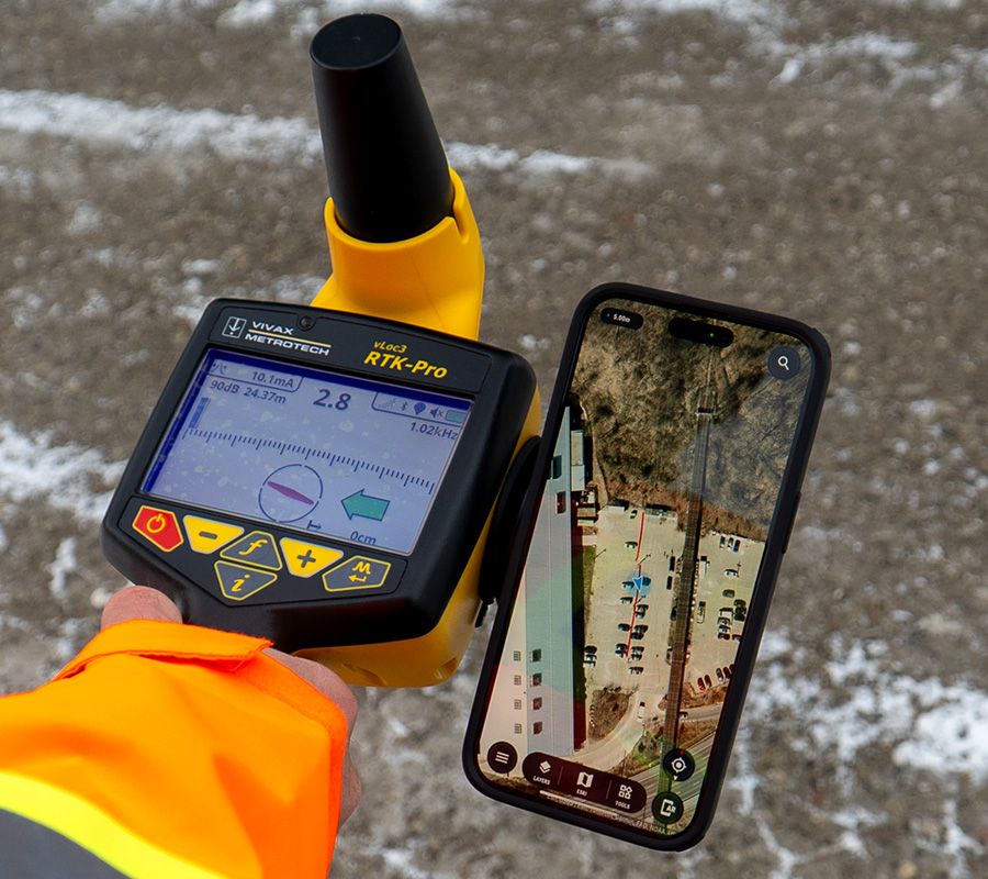
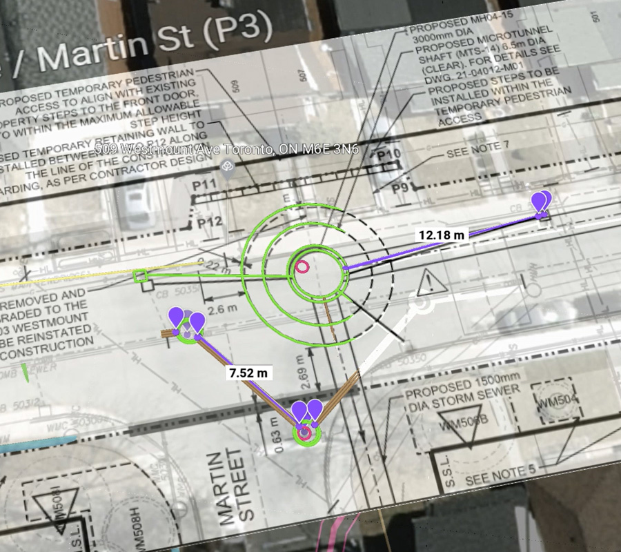
Prevent Line Strikes: See underground utilities with AR before digging and avoid costly, dangerous hits.
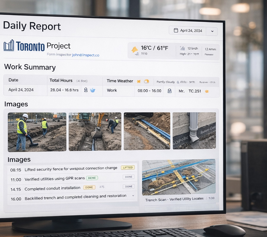
Track Installed Quantities: Log what’s installed—pipes, manholes, trench lengths—right from the field, tied to drawings and locations.
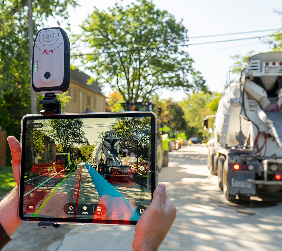
Redline, As-Builts and Data Capture: Mark changes and create accurate as-built directly from your device, no surveyor wait times.
Simplify Daily Reporting: Generate accurate, photo-backed reports as crews work.
Reference Designs in Real Time: Overlay plans and models on the live jobsite to check alignment.
Perform Stakeouts: Guide crews in placing assets exactly where they need to go, using AR and high-accuracy positioning.
Detect Conflicts Early: Identify clashes between planned designs and actual site conditions early.
| Platform Details |
reduction in utility strikes
fewer survey crew visits