Simplify Redlining and Field Data Collection

vSite lets crews perform field edits of GIS data, capture redlines, and create internal as-builts directly on site. Record changes, locate assets, and report real-time locations to keep your project moving without delays or documentation gaps.

The Ultimate Jobsite Documentation Toolkit

vSite empowers field crews to capture GIS data, perform redlines, and create internal as-builts directly on site, using intuitive, survey-grade tools. By enabling teams to handle routine documentation without waiting on surveyors, vSite streamlines workflows while maintaining accuracy and consistency across projects.

With built-in 3D scanning, crews can generate detailed models of trenches, utilities, and installations in minutes. These can be instantly shared with designers or project teams, improving collaboration and speeding up decision-making.

The result is a complete, time-stamped, and geo-referenced record—ideal for fast-paced delivery and long-term asset management. Less rework, fewer delays, and total confidence in your field data.

Explore Case Study

Fast and Accurate Field Data Collection

vSite gives your crews everything they need to collect GIS data, redlines, and internal as-builts.

It’s optimized for speed, user-friendliness, and cost-effectiveness. Whether you’re capturing a quick sketch or structured utility data with 1 cm accuracy, vSite keeps your documentation consistent, precise, and ready to use without slowing down your workflow.

What makes vSite unique is its AR-powered quality control. As crews collect points or draw redlines, vSite overlays the data in augmented reality for instant visual verification—helping even non-specialists achieve survey-grade results with confidence.

vSite works as a standalone system or integrates seamlessly with Esri ArcGIS and other systems, giving you flexibility without added software or complexity.

The standout feature of vSite is its seamless data collection process—simply pick up a few points and lines, scan the assets and surfaces you need, and the system automatically merges everything into a unified digital twin.

  • Dagfinn Solvik-Olsen, CSO
  • Anko AS

Functional Highlights

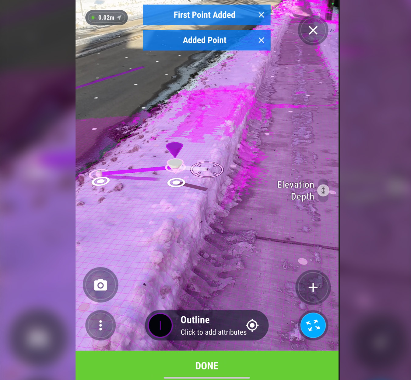
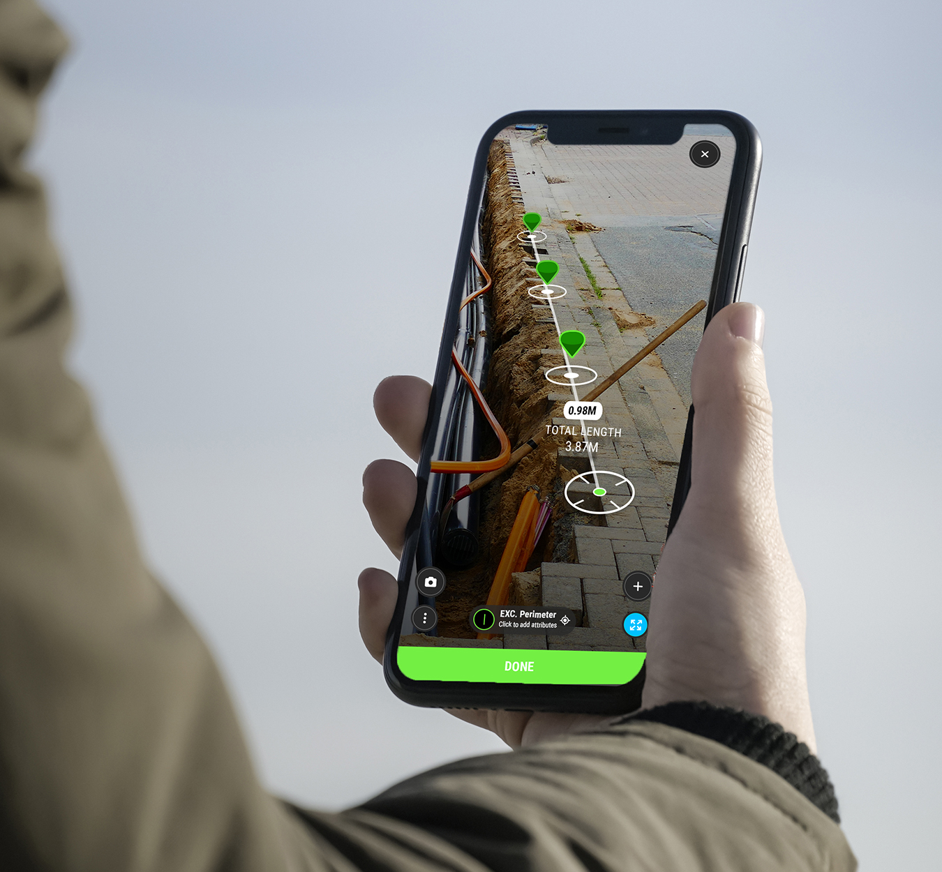
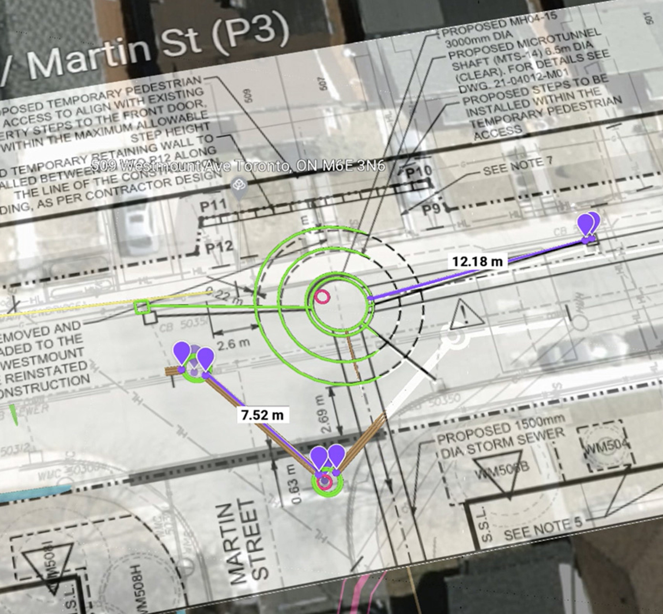
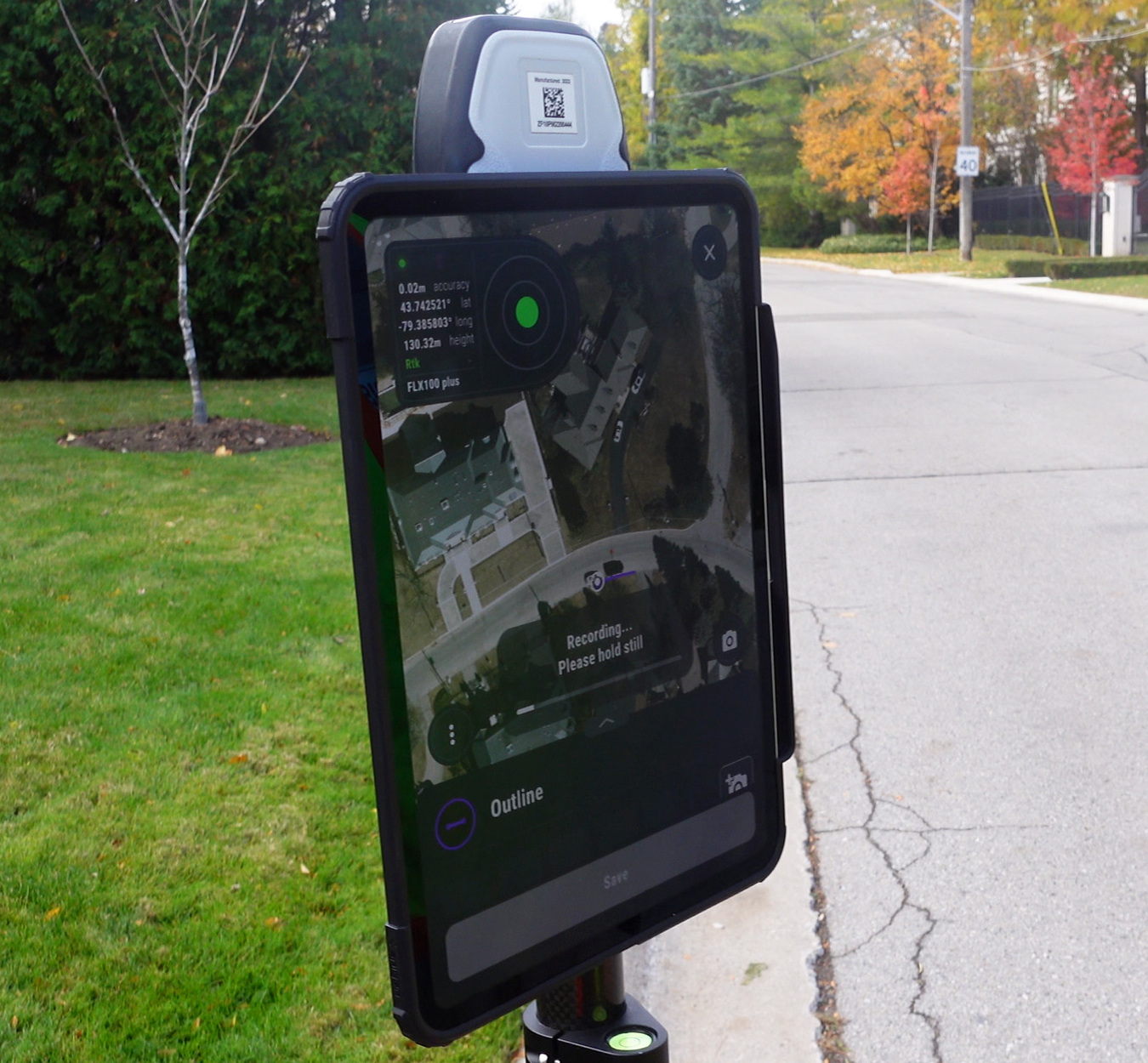
Survey-Grade Accuracy: Capture data with pole-based GNSS or vSite’s AR-powered workflows, achieving cm-level accuracy. Whether collecting from the ground or viewing in AR, vSite delivers field-ready accuracy without complex setup.

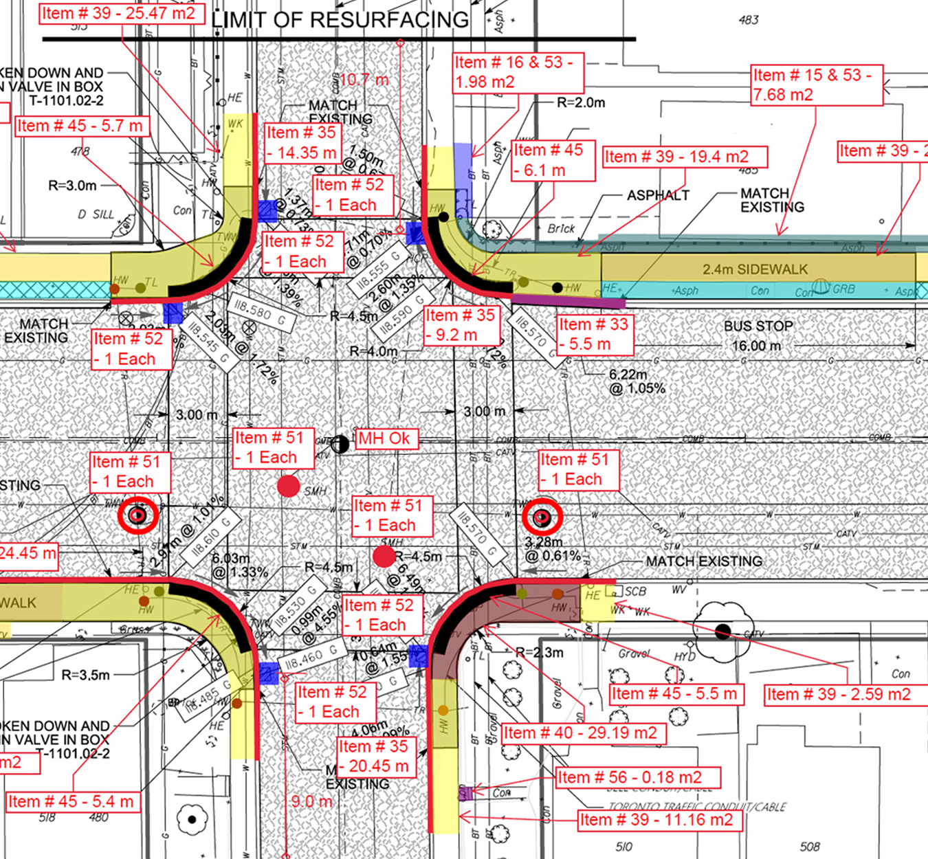
Structured GIS or Quick Redlines: vSite supports both formal GIS data capture and quick, sketch-style redlines. All inputs are geo-tagged and accurate to within cm for consistent, reliable results.

Instant Accuracy Validation: Collect high-quality data with confidence. Using AR overlays, vSite instantly confirms accuracy in the field, enabling non-specialists to document utilities, site conditions, and redlines.

Add 3D Scans to Any Data Point: Augment any record with a 3D scan captured in seconds with iPhone or iPad. Use vSite’s built-in AI to automatically process and extract features.

Flexible Integration. Prefer other surveying tools? vSite integrates with tools like Esri Field Maps and Leica Zeno Mobile, so you can collect with your preferred app and switch to vSite for validation or AR inspection.

vSite Data Collection Pricing
vSite’s redlining and field data collection tools are included in the "Crew" and "Enterprise" plans, or available through "vSite AR" or "AR + Scan" named licenses. Choose the option that fits your workflow.

vSite AR + vSite Scan

Capture GIS data and redlines in one easy-to-use, cost-effective solution.

From $109 USD/month (billed annually)

  • $109 USD/month for vSite AR Stand-Alone
  • $159 USD/month for vSite AR + vSite Scan
  • Single named user with multiple devices
  • Unlimited projects; 10GB storage with expansion option
  • Essential support
Purchase

vSite Crew or Enterprise

Tailored plans ideal for organizations managing large-scale utility networks or multiple projects.

From $750 USD/month (billed annually)

Purchase
  • Flat-fee annual subscription
  • Full access: Web + AR + Scanner
  • Unlimited users and guest access
  • Unlimited projects and storage
  • Premium support
Contact Sales

Jobsite Documentation with vSite

GIS Data Collection with High-accuracy AR

Additional Information

Technical Details

vSite specification and technical details

Learn more

Features

vSite features

Learn more

System benefits

vSite saves you time and helps avoid costly mistakes

Learn more

We've received your request. Thank you.

We've received your request.