vSite AR: Construction-grade Augmented Reality
Precision AR for safer, faster, and more accurate work. Prevent strikes, detect clashes, perform stakeouts, and more—all in one intuitive, user-friendly app.

Precision AR for safer, faster, and more accurate work. Prevent strikes, detect clashes, perform stakeouts, and more—all in one intuitive, user-friendly app.
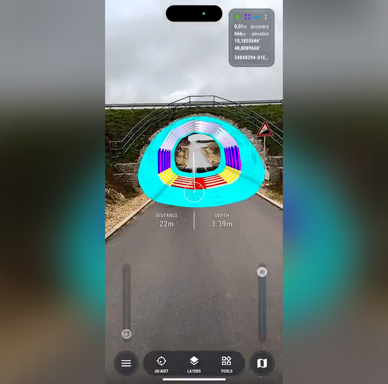
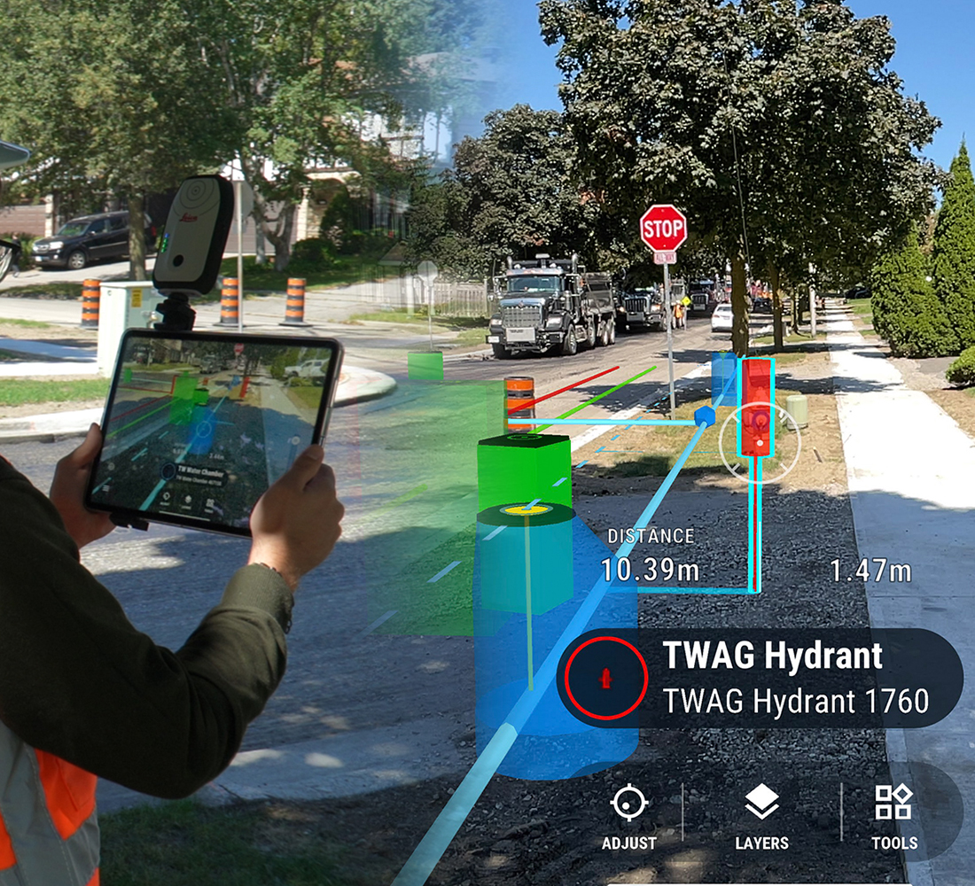
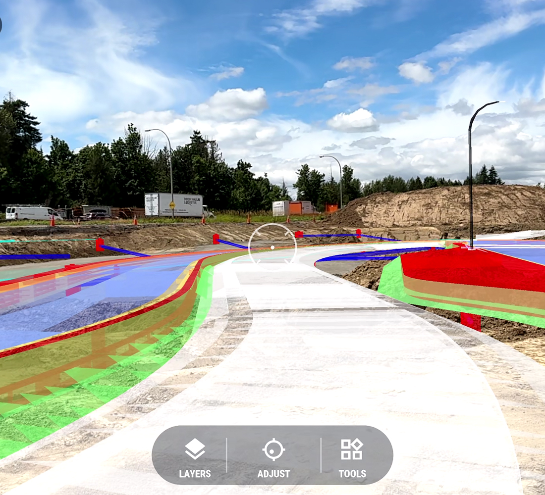
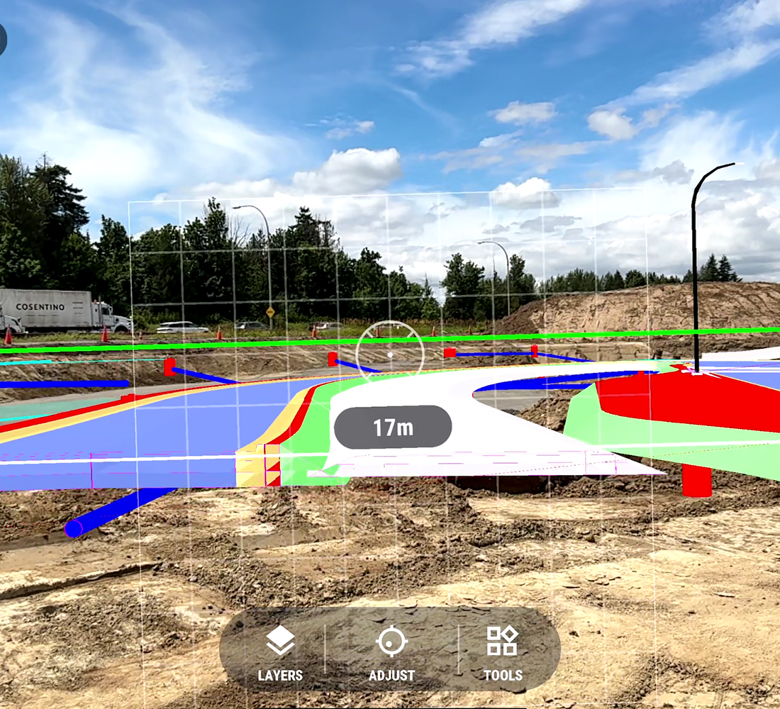
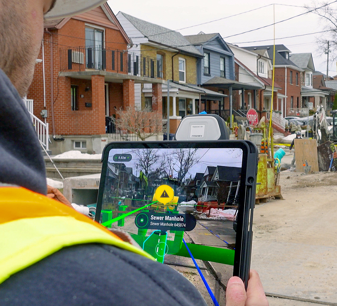
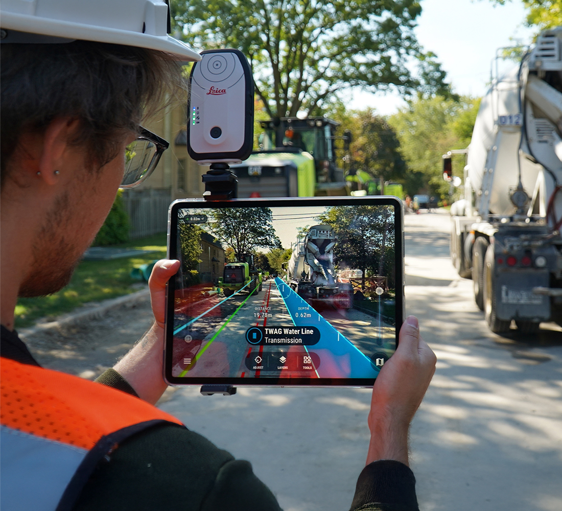
Construction-grade augmented reality with cm-level accuracy enables crews to see underground utilities, design plans, and as-builts overlaid directly on site conditions, making it easy to spot discrepancies instantly.
By perfectly aligning digital and physical environments, vSite AR helps crews avoid line strikes, perform quick quality control checks, and ensure field data matches the plan before work progresses.
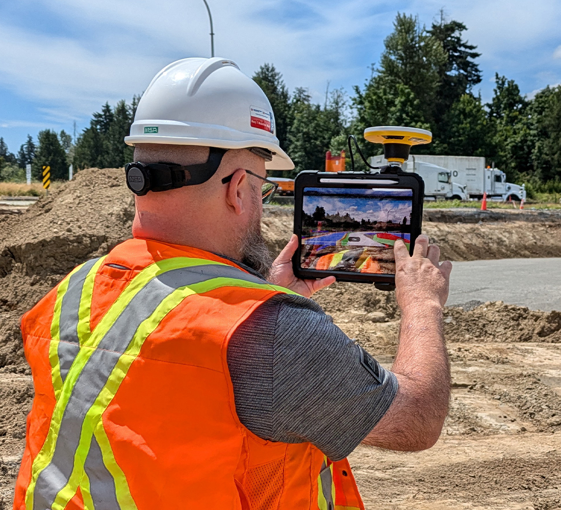
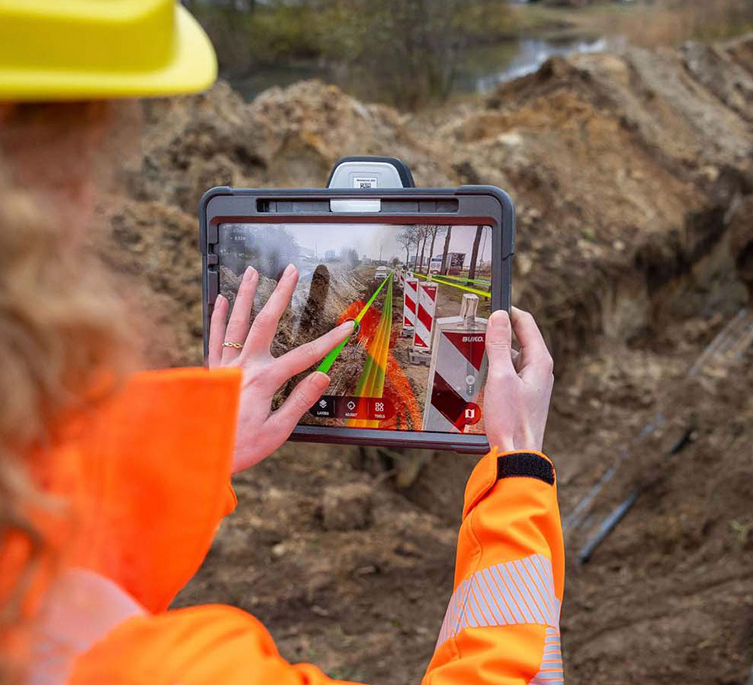
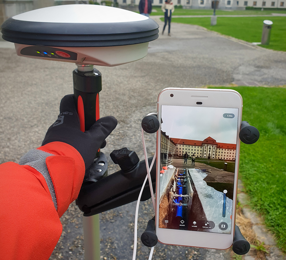
With the ability to perform stakeouts, instantly validate picked-up points, and collect as-built data, vSite AR lets crews work more independently, reducing reliance on surveyors for routine checks and verifications.
| Industry Case Study |
Avoid Strikes Before They Happen: Give your crews the power to see buried infrastructure with precise AR overlays so they dig with confidence, not guesswork. Fewer hits mean fewer delays, injuries, and claims.
Align the Field to the Plan Instantly: Bring drawings, GIS records, and BIM models to life on the live jobsite. Crews can verify locations, check alignment, and catch discrepancies in seconds without waiting for a survey.
Build with Precision, Not Tape Measures: Use AR-guided stakeouts with cm-level accuracy to place pipes, structures, and offsets exactly where they belong, eliminating layout errors before they cost you.
Catch Issues Early: Spot conflicts between design and reality before work goes in the ground. Avoid costly rework, change orders, and project slowdowns.
Generate As-Builts On the Spot: Redline changes and validate installation accuracy directly from your device. No survey backlog. No hand-drawn markups. Just clean, field-verified records.
| Contact Sales |
Construction-Grade Accuracy: Achieve survey-grade positioning in the field with AR that’s accurate down to 1 centimeter—ideal for stakeouts, clash checks, and high-precision installs.
Works with Your Existing Equipment: Compatible with 40+ GNSS receivers, including Emlid, EOS, Leica, and Trimble, so you can deploy high-accuracy AR using the gear you already own.
Supports All Common Formats: Seamlessly load and visualize data from BIM models, GIS layers, and 3D scans, giving crews a complete spatial understanding of planned and existing conditions.
Multiple Sources in One Unified View: Overlay Autodesk models, Esri GIS layers, utility locates, design files, survey data, and redlines in a single AR environment. No app switching, no data silos, just total project clarity.
| View All vSite Features |
Ideal for small teams that need AR visualizations without 3D scanning.
$109 USD/month (billed annually)