Up-to-Date Sheets and Drawings At Your Fingertips

Give crews instant access to the latest drawings anywhere. vSite complements paper plans with a lightning-fast digital viewer that maps sheets to real project locations, so teams can detect clashes, spot changes, add precise redlines, and keep projects on track.

Your Drawings—Faster and Smarter

Paper plans and PDFs can slow crews down. vSite complements them with fast-loading, GPS-aware drawings that sync instantly across every device so your team always has the latest sheets.

Crews can view their exact location on the drawing, overlay it in 3D or AR, and redline changes with 1 cm precision. Every markup is georeferenced, timestamped, and shared in real time—turning field edits into accurate, trackable as-builts.

Industry Case Study Coming Soon

A Simple Start with Powerful Upside

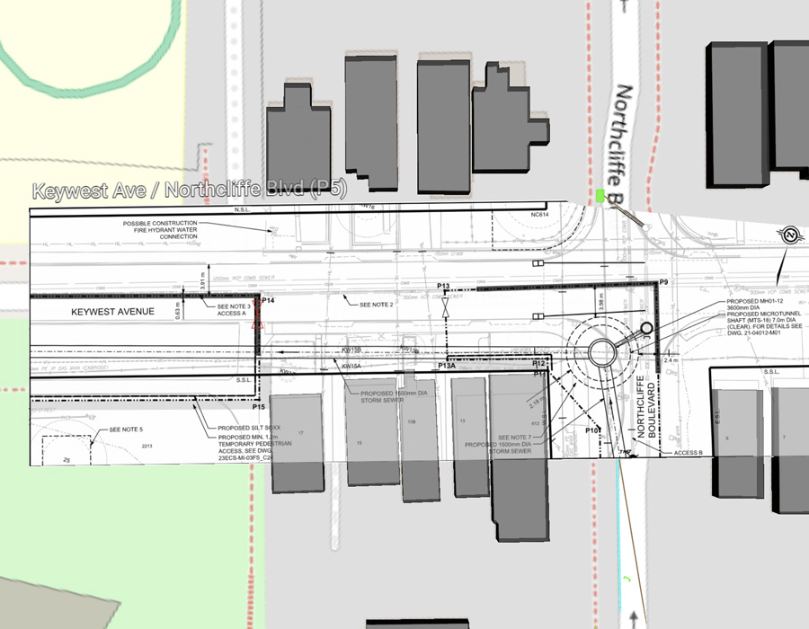
Most construction teams still rely on sheets. Sheets are familiar, flexible, and widely used in the field. vSite supports that workflow by making the transition to digital seamless: crews can keep working with the same drawings they trust, while gaining instant access to digital versions on mobile devices.

vSite makes going digital easy: just upload your existing PDF plans. Crews can zoom, swipe, and mark up drawings with no learning curve, making adoption fast even for teams used to paper.

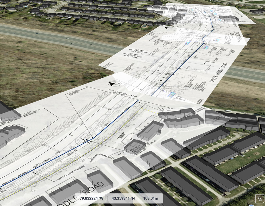
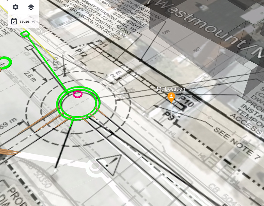
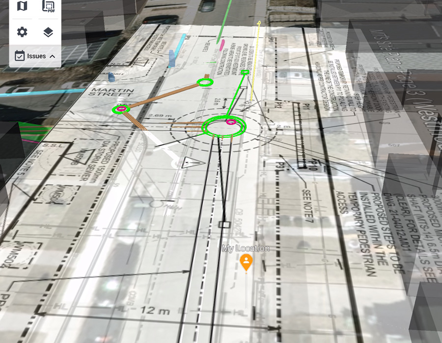
Once digital, your plans unlock powerful features: compare revisions, overlay drawings in AR, or view them on the map as part of your project’s digital twin. vSite ties your drawings into everything—BIM, GIS, scans—so field and office stay connected with one source of truth.

The standout feature of vSite is its seamless data collection process—simply pick up a few points and lines, scan the assets and surfaces you need, and the system automatically merges everything into a unified digital twin.

  • Dagfinn Solvik-Olsen, CSO
  • Anko AS

Feature Highlights

Always Up-to-Date: Automatic cloud syncing delivers the latest plan sets to every device, eliminating version mix-ups and costly rework.

Survey-Grade Redlines: Mark up drawings with 1 cm accuracy using high-precision GPS, creating as-builts you can trust and removing guesswork from field notes.

3D & AR Visualization: View sheets in an interactive 3D map or overlay plans on the real world with AR, helping teams align drawings to actual site conditions and catch issues early.

Smooth Transition from Paper: 100% compatible with standard PDF drawings and intuitive to use, vSite makes going paperless easy – minimal training, maximum adoption.

Blazing-Fast: Open large multi-page PDFs in seconds, so crews aren’t left waiting in the field.

vSite Sheets and Drawing Pricing
vSite’s redlining and field data collection tools are included in the "Crew" and "Enterprise" plans, or available through "vSite AR" or "AR + Scan" named licenses. Choose the option that fits your workflow.

vSite AR + vSite Scan

Capture GIS data and redlines in one easy-to-use, cost-effective solution.

From $109 USD/month (billed annually)

  • $109 USD/month for vSite AR Stand-Alone
  • $159 USD/month for vSite AR + vSite Scan
  • Single named user with multiple devices
  • Unlimited projects; 10GB storage with expansion option
  • Essential support
Purchase

vSite Crew or Enterprise

Tailored plans ideal for organizations managing large-scale utility networks or multiple projects.

From $750 USD/month (billed annually)

Purchase
  • Flat-fee annual subscription
  • Full access: Web + AR + Scanner
  • Unlimited users and guest access
  • Unlimited projects and storage
  • Premium support
Contact Sales

See vSite In Action

Jobsite Documentation with vSite

GIS Data Collection with High-accuracy AR

Additional Information

Technical Details

vSite specification and technical details

Learn more

Features

vSite features

Learn more

System benefits

vSite saves you time and helps avoid costly mistakes

Learn more

We've received your request. Thank you.

We've received your request.