Fast When You Need It; Detailed When It Counts
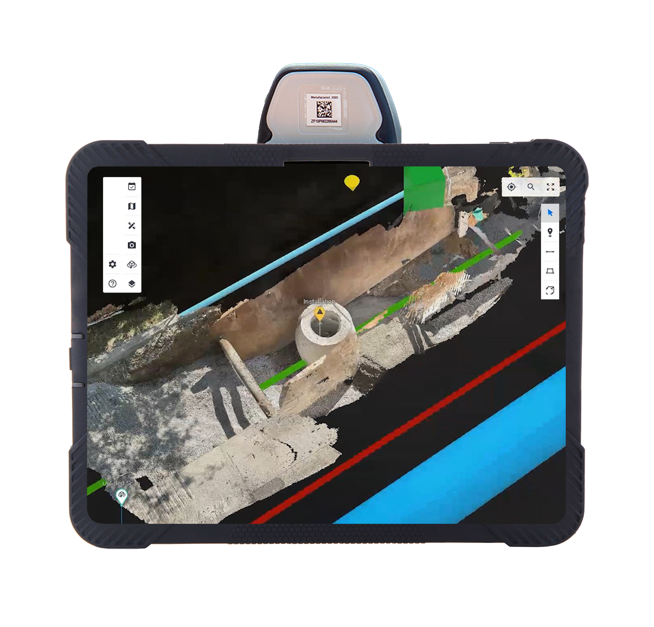
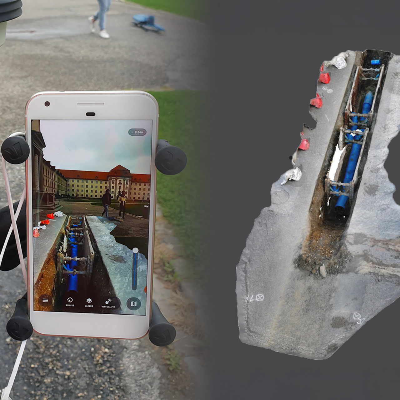
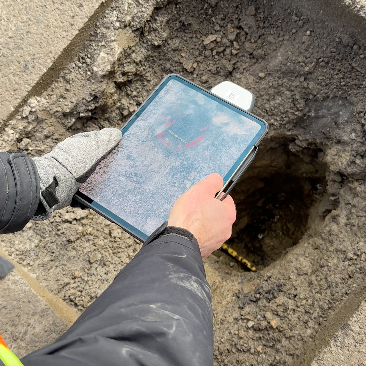
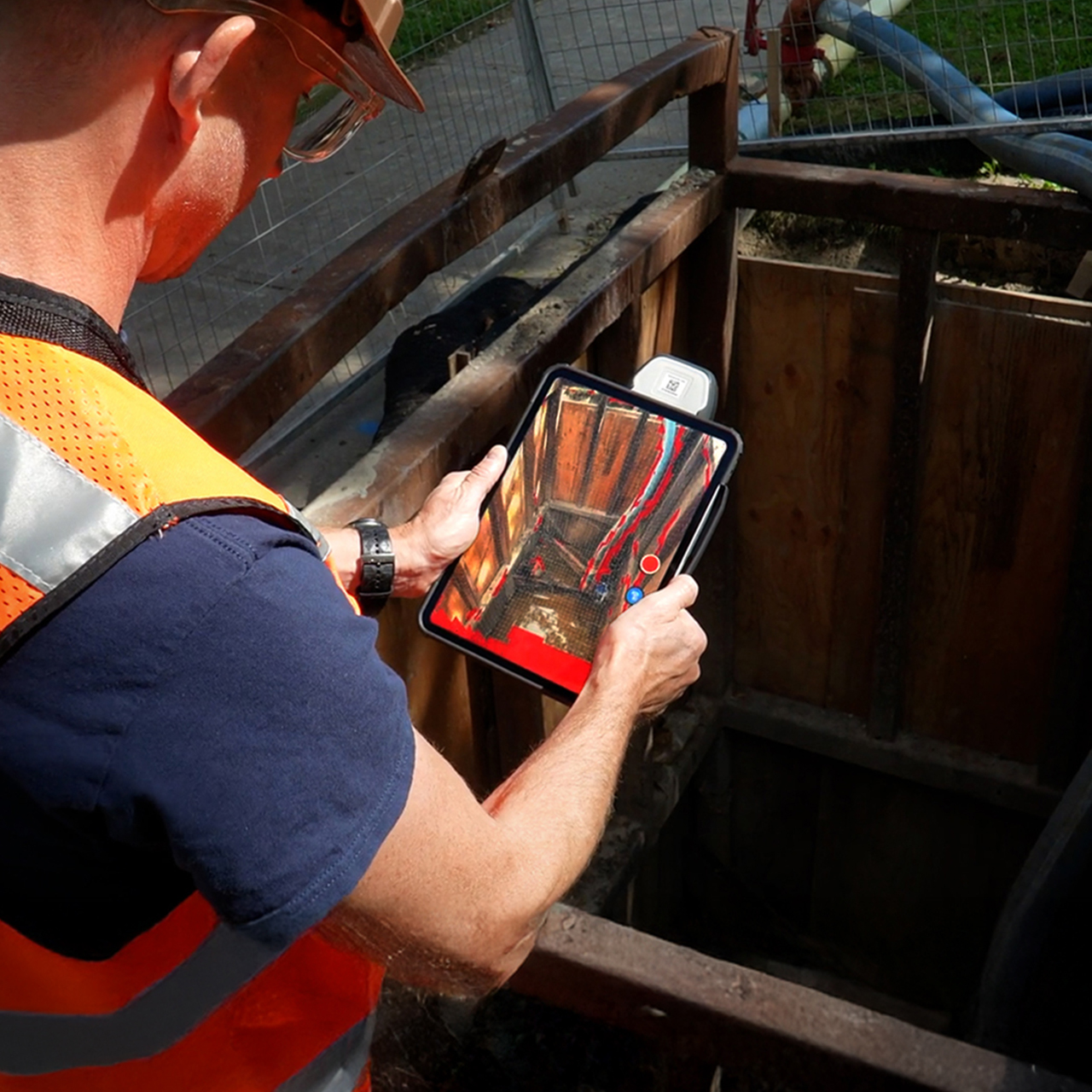
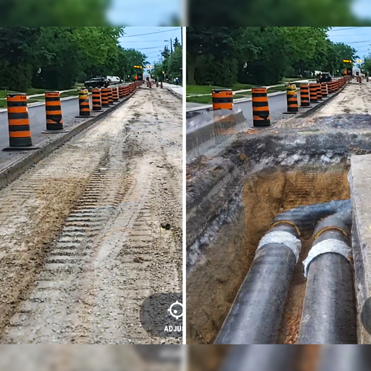
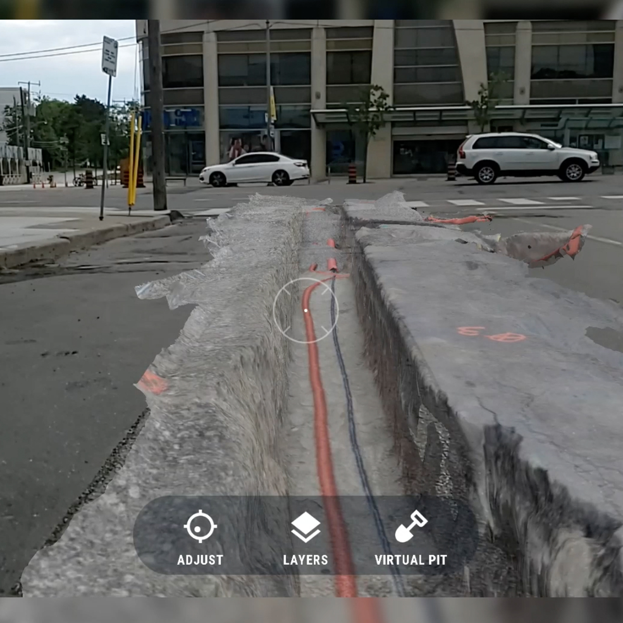
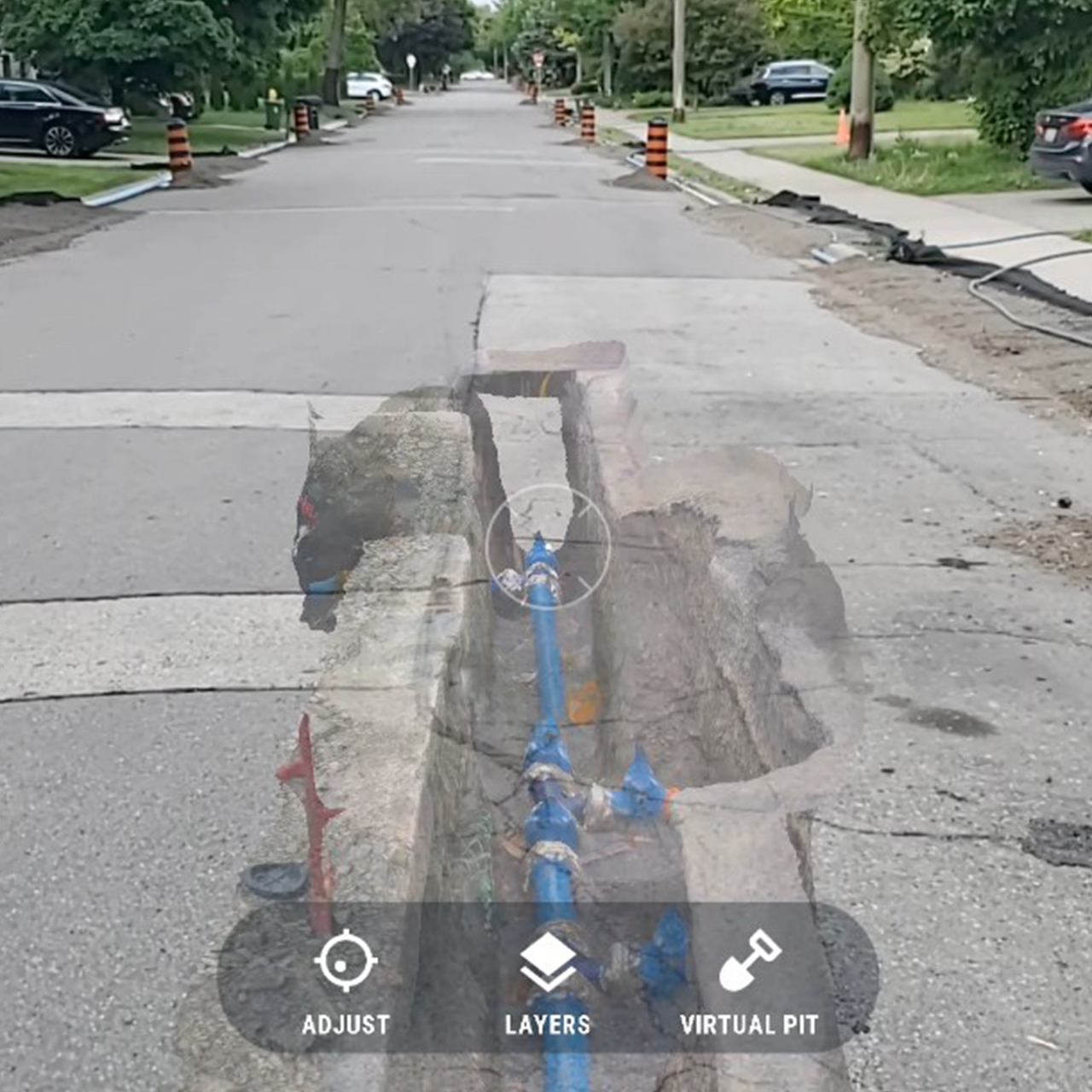
Instant Field Scanning: Quickly scan open trenches, utilities, or in-progress work using an iPhone or iPad. vSite generates real-time 3D visuals in the digital twin, helping crews and supervisors validate installs, resolve issues, and make decisions without delay.
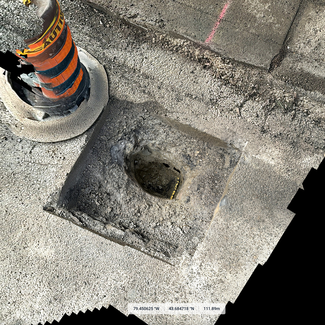
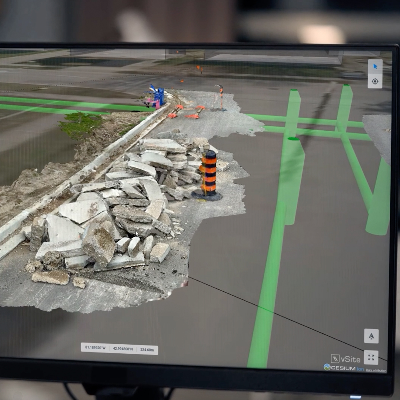
Full-Site Photogrammetry, No Drones Needed: Capture entire job sites in high resolution with vSite’s photogrammetry workflow, ideal for detailed as-builts or project documentation.
Precision Visuals in the Field: vSite merges 3D scans with BIM models and GIS records in AR or digital twin views, delivering centimeter-level accuracy and real-world context to guide installs and verify work.
Direct Integration with Your Systems: All scans and metadata can sync automatically to your Esri ArcGIS or CAD system, eliminating manual file handling and keeping your records current and connected.