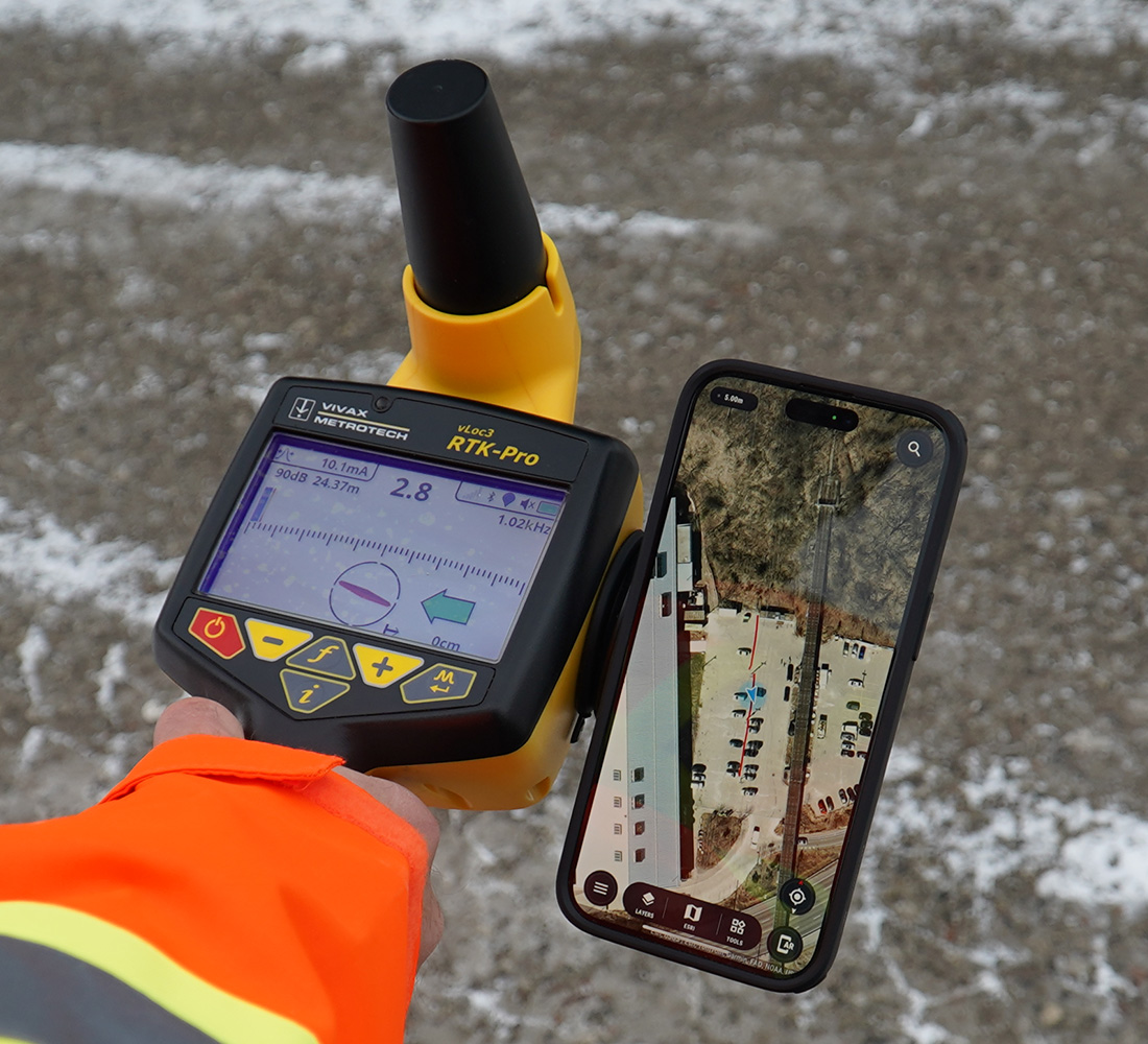
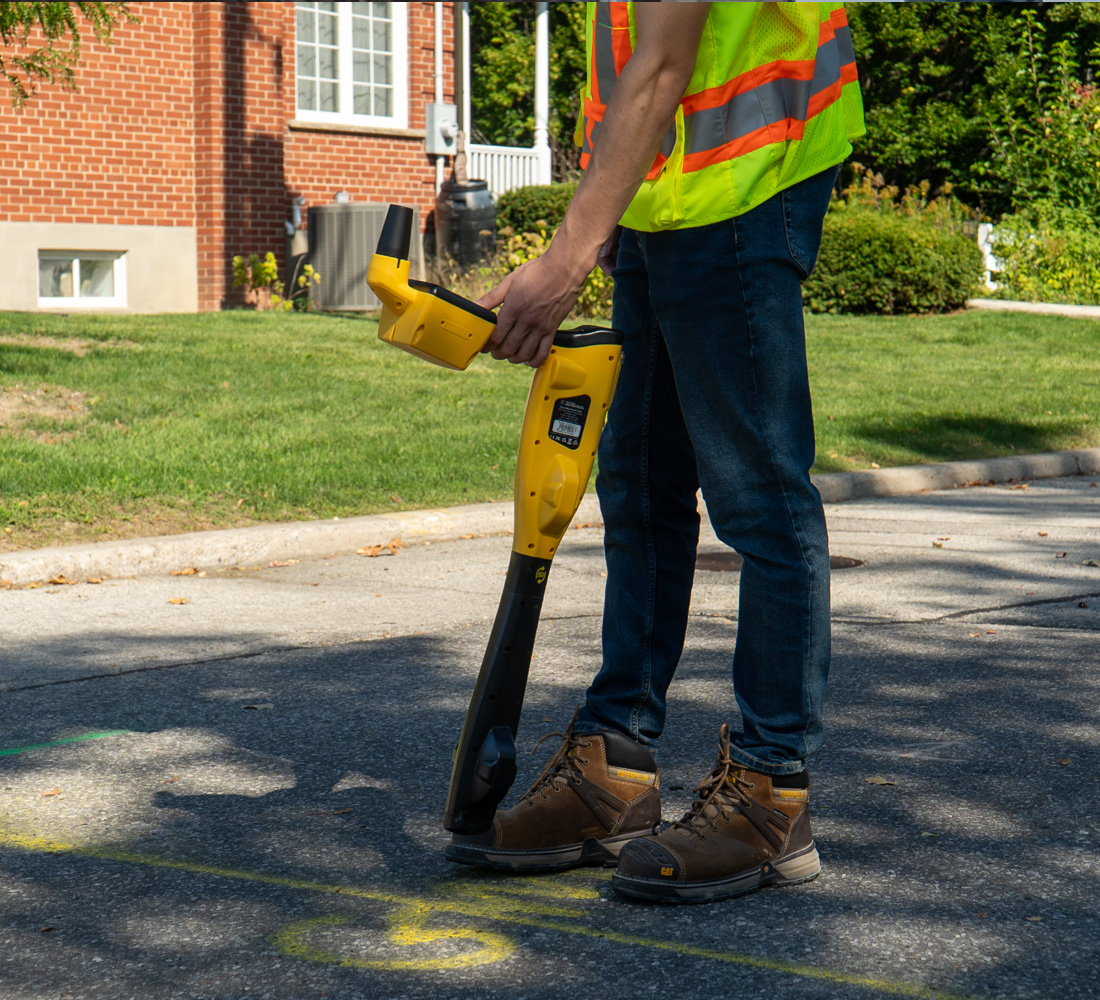
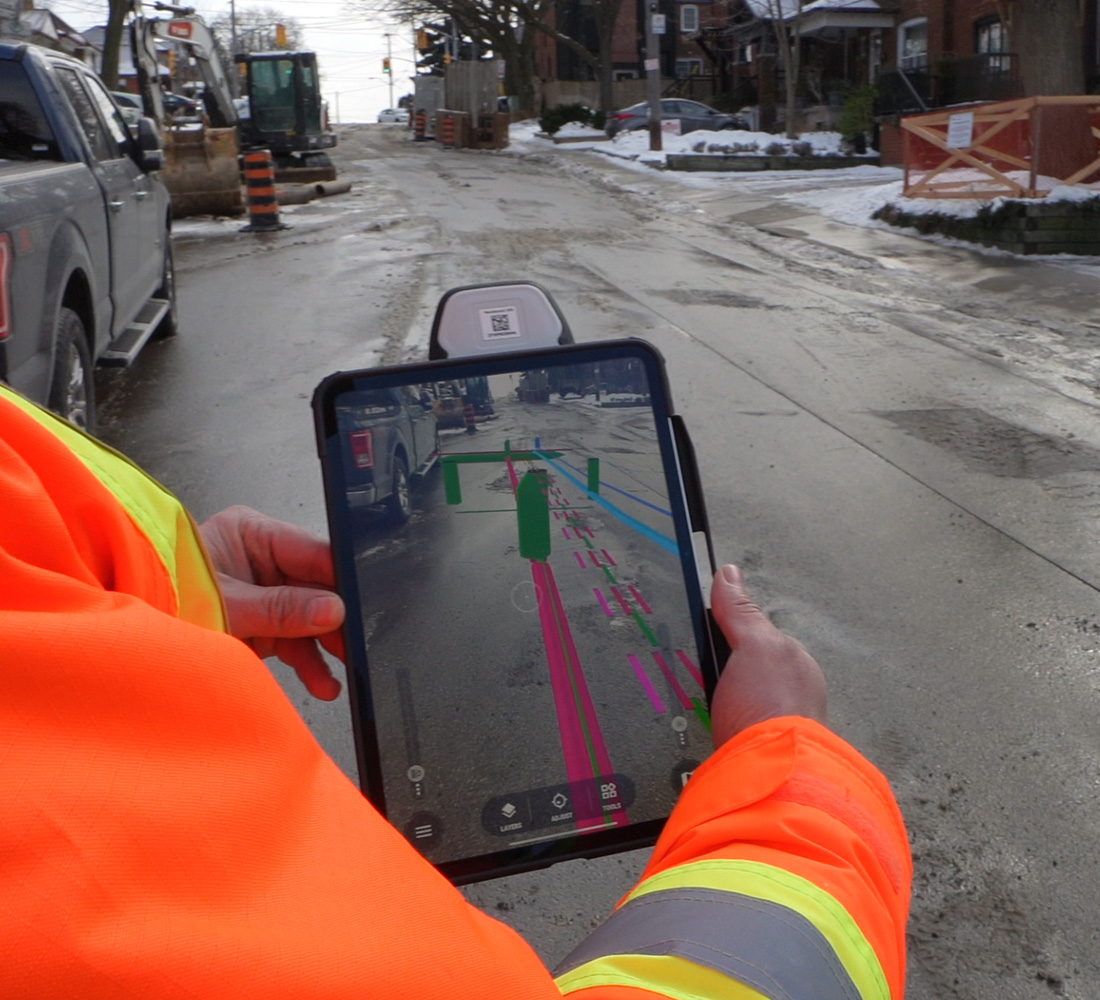
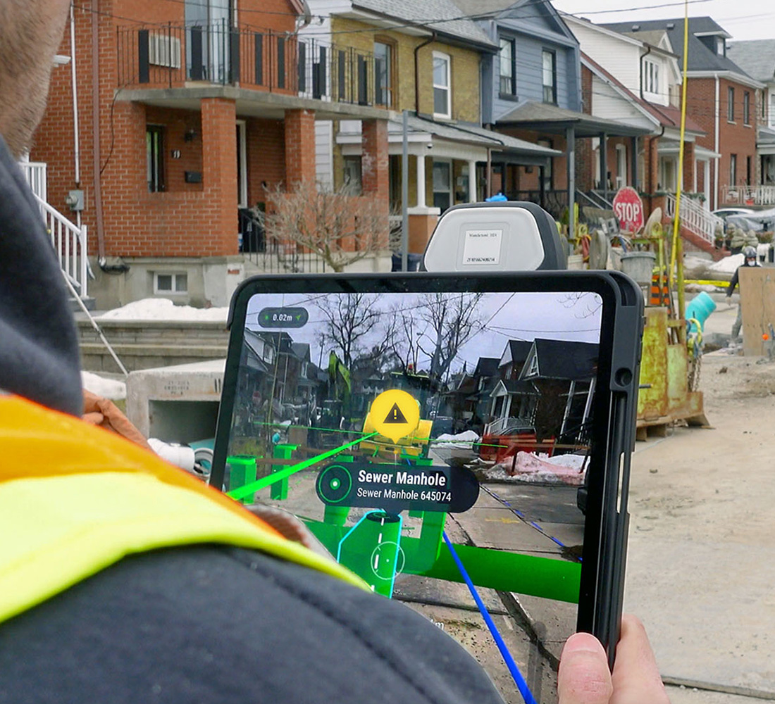
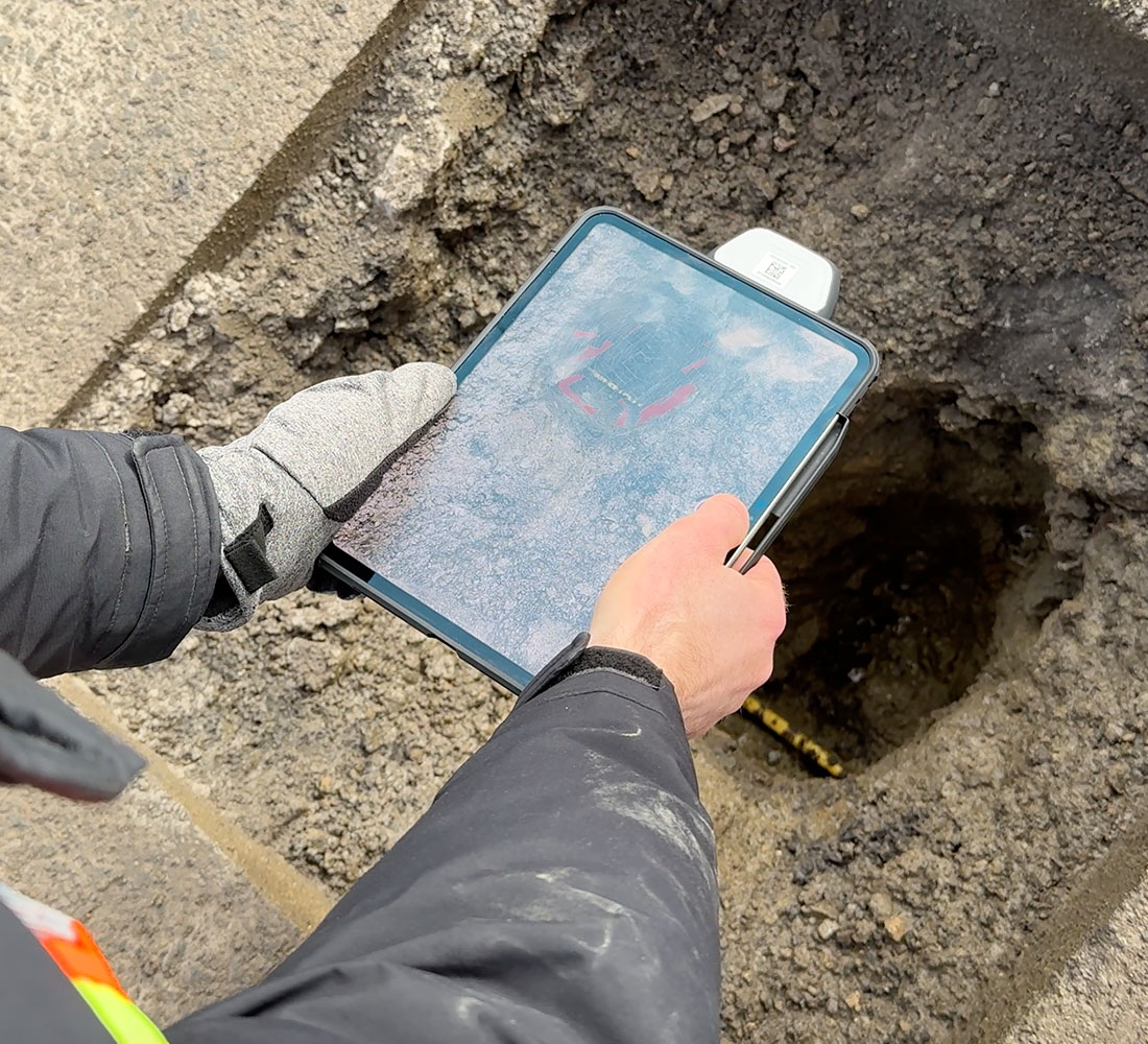
vSite helps prevent utility damage by giving crews real-time spatial awareness on the jobsite. With augmented reality and a live digital twin, workers can see exactly where they are relative to known buried infrastructure.
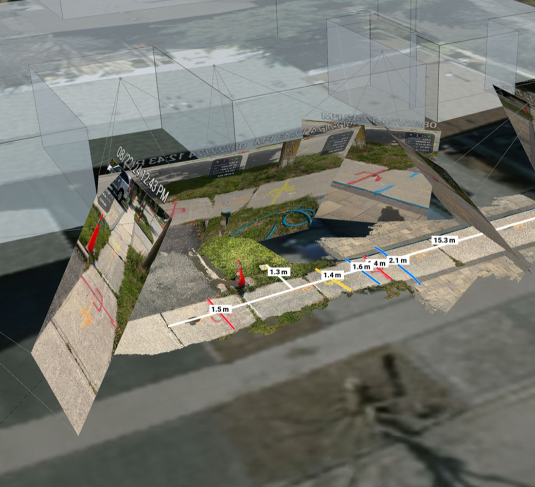
When undocumented assets or unknown lines are discovered, vSite allows crews to scan and record them instantly using an iPhone or iPad. Test pits, surface markings, and exposed utilities can be captured as accurate, geo-referenced 3D models. This information can be viewed later, making it easy to reuse and verify in future phases or during re-marking.
Combined with utility locate documentation workflows, vSite delivers a complete damage prevention solution: visibility before digging, real-time capture in the field, and a digital record that lasts beyond the job.