Esri UC is just two months away! Over five days, this conference will provide more than 450 hours of training, hundreds of user presentations that share best practices, and opportunities to get specific technical questions answered one-on-one by Esri subject-matter experts, developers, industry leaders, and more. Over 18,000 professionals representing nearly every commercial sector, government organization, and nonprofit field attend the Esri UC.
This year, vGIS will be there! The vGIS team has expanded its conference involvement with two presentations, an exhibition and sponsorship engagements.
Presentation Session
Augmented Reality (AR)/Virtual Reality (VR) Special Interest Group with Rex Hansen
vGIS is joining forces with Rex Hansen, Product Manager at Esri, to discuss the current and future states of AR/VR technologies in the context of GIS. This session offers a unique opportunity to get insights from both the internal Esri AR/VR R&D team and the leading independent AR/VR developer for GIS. This is a must-attend session for any GIS specialists looking to understand AR/VR.
ArcGIS and Augmented Reality (AR)/Mixed Reality (MR) Visualization Technologies—Real-Life Use Cases
vGIS CEO Alec Pestov will discuss real-life use cases of AR/VR for ArcGIS. The presentation covers diverse scenarios in which companies applied AR/VR technologies to take their existing ArcGIS data to the next level. This session will focus on the practical applications of AR/VR that have brought tangible benefits to the organizations deploying the technologies.
Exhibition
vGIS be showcasing the vGIS suite of augmented reality, mixed reality and virtual reality applications at the Esri UC. Please come and see us at Kiosk #Z9.
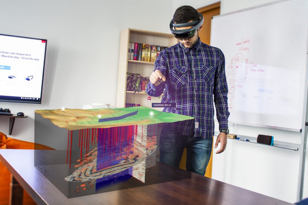
In addition to the critically acclaimed vGIS Utilities—an augmented reality GIS application that lets you “see” underground utility infrastructure—we will be unveiling a brand-new system designed specifically for oil and gas companies. vGIS Exploration is a HoloLens-based mixed reality tool for visualizing geology, well structure, production, extraction and seismic events, among other things. Working in conjunction with the ArcGIS back-end, the system improves common analyses and decision-making processes of exploration companies.
We are ready to meet with you to demo vGIS Utilities and vGIS Exploration. Stop by Kiosk #Z9 any time.
We are also happy to meet with you and your team in private. To arrange a meeting, please email us to set a mutually convenient time.