In the world of augmented reality and spatial data visualization, accuracy in perception is everything, especially when applied to high-stakes industries like construction. One visual phenomenon that can confuse users in AR environments is known as the Parallax Effect.
What Is the Parallax Effect?
The Parallax Effect is the apparent shift in the position or direction of an object when it is viewed from different angles. A simple example can be seen when looking through a camera viewfinder: an object may appear in a different location than it does through the lens. This effect is a normal part of how our eyes and brains interpret spatial relationships.
In real-world terms, it’s what allows us to perceive depth. You’ve likely seen this effect in modern first-person shooter (FPS) video games, where enemy characters or objectives are highlighted through walls. As you move around, the highlighted outline may appear to “float” or shift position because your perspective is changing, even though the actual character remains fixed behind the wall. See an example of this phenomenon below:
In augmented reality, a similar phenomenon can happen when visualizing objects that are underground or hidden by terrain. Without a visible reference on the surface, the 3D object can feel like it’s moving with you, leading to disorientation if not managed carefully.
Case Study: Pipelines and Perception
Recently, one of our vSite AR clients raised a concern: when using our platform to visualize an underground pipeline, the 3D object appeared to “move” as the user walked around the site. Instead of remaining static in space, the pipeline seemed to track the user’s movement, an unexpected effect when dealing with infrastructure expected to remain firmly in place.
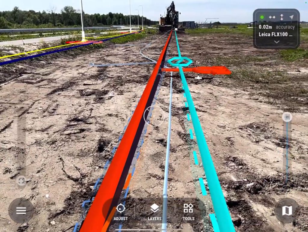
This is a typical case of the parallax effect at work. Because the pipeline was rendered below ground and lacked surrounding context (such as reference structures or visible terrain), the user’s brain struggled to anchor its position. The result? The object felt as though it was shifting location.
How We Address It
To correct for this effect and improve the user’s spatial understanding, we apply a straightforward but effective visual patented strategy:
- The 3D object (in this case, the pipeline) remains positioned exactly where it exists in real-world coordinates, below the surface.
- At the same time, we add a simple visual indicator on the ground surface directly above the object’s true location. This gives the viewer a clear, fixed reference point, helping them understand where the underground object would be if they were to dig straight down.
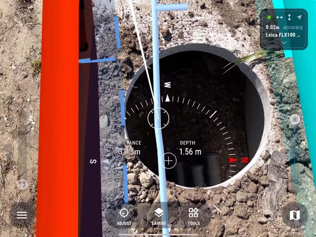
By providing both the actual placement of the object and a visible surface reference, users can better judge its true location, reduce confusion, and reinforce spatial accuracy.
Why It Matters
For construction teams, utility locators, and GIS professionals working with underground infrastructure, understanding how human perception interacts with digital overlays is essential. Misinterpreting the location of subsurface assets can lead to safety risks, planning errors, and costly rework or repairs — sometimes resulting in significant financial losses and project delays.
At the intersection of augmented reality and geospatial data, solutions like ours help mitigate these risks by combining accurate real-world positioning with clear visual cues that anchor digital objects to their true locations. By reinforcing spatial accuracy, our system gives users the confidence they need to make informed decisions, avoid costly mistakes, and keep projects moving safely and efficiently.