
vSite User Case: City of Ottawa
The City of Ottawa is positioning itself as a national leader in geospatial innovation, with a digital twin program that is already reshaping how the city manages infrastructure, planning, and public services.
Speaking with vGIS, Jean-François Dionne from the City of Ottawa highlighted just how far the city has come. “We already have a twin that’s available and ready to interact and work with yours. We have all our zoning bylaws in 3D, our utilities in 3D, and inspectors collecting new data daily. This is not a pilot, we’re operating at scale.”
Building a Digital Twin Ecosystem
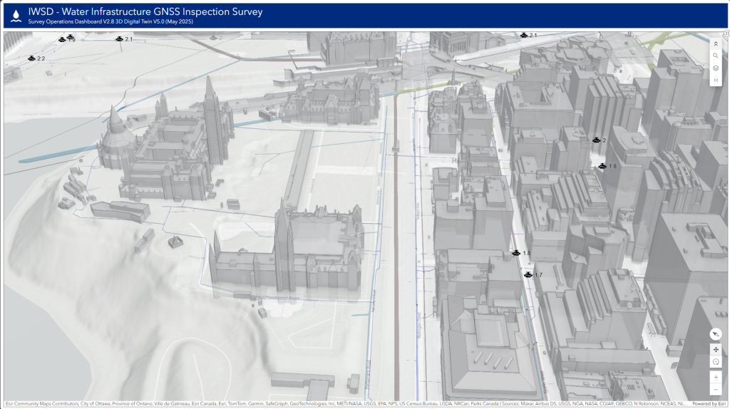
At the heart of Ottawa’s progress is the O-Twin Viewer, a platform that brings together diverse streams of geospatial data. From LiDAR scans and point clouds to zoning bylaws and utility networks, Ottawa is assembling a comprehensive 3D model of the city. The effort is backed by advanced infrastructure, including Cesium Ion on-premises and Azure-based storage to manage massive volumes of data. With mobile mapping systems collecting one terabyte of new data per day, Ottawa’s approach is nothing short of ambitious.
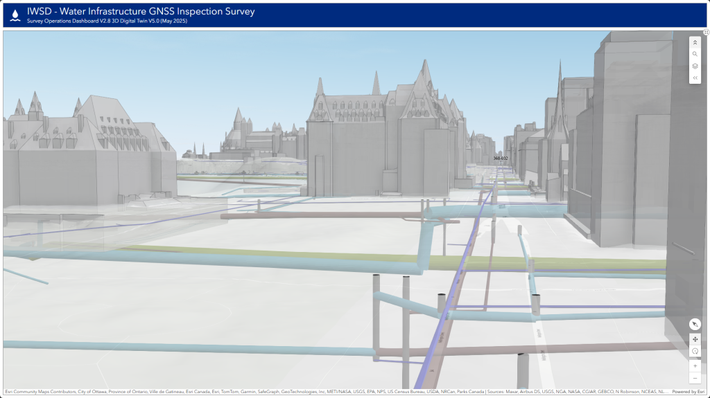
This system is already proving its worth. Roughly 7,000 kilometers of roads are being mapped with 360-degree imagery and LiDAR, covering both urban and rural areas. Underground utilities, storm sewers, and other critical infrastructure are being digitized into the twin, creating a seamless link between above-ground and below-ground assets.
From Data to Decisions
Ottawa’s digital twin isn’t just about visualization; it’s a decision-making tool. Using generative AI models built in collaboration with Esri’s R&D team, planners can simulate neighbourhood development scenarios directly in 3D. By applying zoning bylaws, density metrics, and land-use rules, they can instantly test how different policies would reshape corridors and communities.
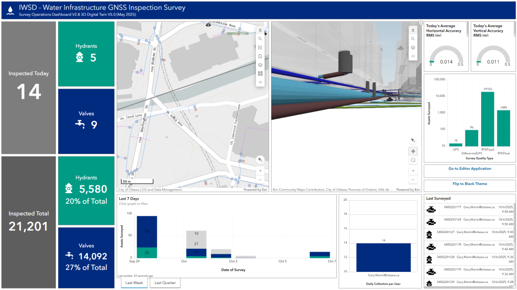
At the same time, inspectors are feeding real-time field data into the system using RTK-enabled tools. This near real-time integration ensures that the twin reflects current conditions, enabling more accurate planning, faster inspections, and proactive infrastructure management.
Ottawa has also begun applying machine learning to its massive imagery library, training models to automatically recognize and catalogue traffic signs, light poles, and street markings. By combining imagery with LiDAR data, the city is building a next-generation asset inventory that will support everything from road safety to construction planning.
Recognition and Impact
These achievements have already been recognized internationally. Ottawa won the 2023 Esri Special Achievement in GIS Award and showcased its work at the G7 conference on housing.
“Ottawa’s success with digital twins is sparking a national conversation,” said Randal Rodger, Program Manager for Geospatial Analytic Technologies & Solutions. “We’re not just building tools—we’re shaping a new way of thinking about urban data, collaboration, and immersive planning. As more municipalities reach out, we’re helping define the standards and strategies that will guide Canada’s next generation of smart cities.”
As Dionne noted, the digital twin is not a concept for the future; it’s a living system already transforming how Ottawa works.
Where vGIS Fits
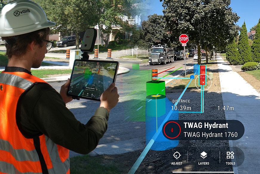
The City of Ottawa sees vGIS as a critical partner in this journey. By connecting immersive AR field tools with the city’s growing digital twin, inspectors and contractors can collect and view data in real time, ensuring accuracy and speeding up workflows. As Dionne put it, “Having vGIS as part of our ecosystem is going to blow everybody’s mind.”
From large-scale projects like the Parliamentary Precinct redevelopment to everyday utility inspections, Ottawa’s digital twin strategy is a model for other municipalities. It shows how forward-thinking use of GIS, AR, AI, and open standards can bring a city closer to real-time, data-driven governance.
Ottawa is not just building maps; it’s building the future of urban management.